Red-eye escapes

(To be crossposted at carfreechicago; please add comments there)

Got a free weekend? Like trains? Amtrak offers car-free Chicagoans plenty of chances to make a quick one- or two-day weekend escape with “red-eye” (overnight) trains from Chicago to several cities that are a few hundred miles away. I like traveling overnight, since it offers maximum sightseeing time at your destination and cuts back on expensive hotel stays.

Thrifty, non-fidgety sorts can travel in coach for less than the price of airfare, and typically right into downtown. Those who prefer a little more pampering can spring for a sleeper, which offers complete privacy, a flat bed, and free meals. In either case, you’ll travel without road rage or air rage, and usually without worrying much about ground transportation on the other end. One drawback is that slow trains put most of the East Coast out of reach.

Some cities worth a weekend visit:

  • Memphis via the City of New Orleans
  • Pittsburgh or Cleveland (a long day) via Capitol Limited
  • Cincinnati (a long day); Charleston, W.Va.; Beckley, W.Va. (near the Winterplace ski resort); White Sulphur Springs, W.Va. via Cardinal
  • Cleveland (a long day) or Buffalo via Lake Shore Limited
  • It might be possible to arrange a long weekend, although with an early departure and late arrival, in Denver or Winter Park via the California Zephyr

The many short-haul lines out of Chicago can be used for day trips to locations too close for an overnight. Destinations include:

Megabus also offers many overnight trips for cities that are a little bit closer by, or for which Amtrak has inconvenient day schedules — and boasts its famously low prices. Granted, it doesn’t offer quite the space that Amtrak affords you, but its (mostly) clean, new buses certainly put a new face onto intercity buses. Their overnight destinations include Cleveland, Columbus, Cincinnati (a long day), Minneapolis, Kansas City (a short day), and St. Louis. Day trip options include Indianapolis, Madison, and Milwaukee.

J-diversification

Two video games that I spent much time with during high school suddenly make so much more sense — after wandering around Japanese cities for a few days. A-Train and SimTower, both of which were published in the USA by Maxis (creator of SimCity), have at their hearts urban and business models that respond to conditions quite unique to Japan — a society that, despite its considerable automotive might, practically defines “transit oriented development.” Both games were fascinating looks into the integrally interlinked role that transportation, both horizontal and vertical, plays in a densely populated society.

In A-Train, the game player is put in charge of a for-profit commuter and freight railway system serving local travel within a growing metropolitan region. As with Japanese rail systems, the lion’s share of potential profits stem not from railway operations but from the two “ancillary” businesses also in the simulation: property development and stock market speculation (based on the “keiretsu” cross-holdings model that was an integral part of the “Japan Inc.” business model).

Indeed, a 1997 study by Takahiko Saito comparing Japan’s “major private railways” found that 55% of operating profits (aka EBITDA, an earnings figure that excludes capital spending) stem from non-transportation operations. In most cases (and in the much larger case of Hong Kong’s MTR) property development, management, and operations were the largest contributor to profits — oh, and note that buses are usually run at a loss, presumably because they support profits elsewhere in the operation. (Even in U.S. regions with privately operated commuter buses, like Coach USA’s lines in New Jersey and Wisconsin, public subsidies play a key role.)

Ratings and Investment Information, a financial research firm, confirms that is still the case for the private railway sector: “transport’s contribution is… just under 50%” of EBITDA cash flow. The mainline railway business is just not that profitable, despite the railways being in a uniquely ideal profit-generating situation, with uniformly high densities across huge urban areas, and very aggressive management. Saito writes:

The fact that railway companies engaged in commuter transport in large cities could maintain sound management without government subsidy is remarkable to managers of railway companies in other countries. The traffic market in large Japanese cities is extremely favourable to railway management.

One strange “bug” that the game’s Wikipedia entry notes results from an anti-trust situation: the human player competes against the simulation to develop property, but only the player can place certain high-value developments (particularly recreational facilities like stadia, golf courses, and ski resorts). Since the player has a monopoly on these facilities, their market value is bid up tremendously, and their construction offers a ready source of cash and/or leverage opportunities. Indeed, winning the game seems well nigh impossible without exploiting this loophole; in particular, the capital cost of building new rail infrastructure simply cannot be recovered solely through railroad profits.

The game curiously omits the notion that freeways would compete with the rails for intra-urban traffic. The cost of driving in Japan — despite the lack of a Singapore-style conscious price-rationing system for road space, a combination of high tolls (a crosstown roundtrip can easily cost $40, as the expressways are also privately owned) and high prices for imported gas — discourages single occupant car trips.

(Of course, long distance rail companies in Japan still cheerily accept government subsidies for capital costs and to cover operating deficits in rural areas — a formula that could serve Amtrak well, except that almost all of America is “rural” by Japanese standards.)

SimTower gives the player a blank slate of land upon which to build a mixed-use skyscraper. Here, the transportation challenge is vertical, rather than horizontal: arranging a menu of wildly varying mixed uses (offices, condos, shops, hotel rooms, ballrooms, fast food, restaurants, cinemas, lobbies, a wedding chapel, a subway station, parking) around various circulation elements (local and express elevators, stairs, and escalators). Many of the simulated occupants were assumed to never leave the tower in the course of a day.

Mixed-use skyscrapers certainly aren’t unheard of in the USA, but the degree to which uses are mixed together and shoehorned in is far greater in land-short Japan: dozens of blocks in even small cities are lined with three-to-ten story buildings, perhaps on 3,000 square foot sites, stacked high with shops, fast-food joints, and bars. Underground retail concourses, second-floor shops, even food courts high inside skyscrapers and department stores don’t just exist, they thrive. One particular thing that surprised me about the game was the occupants’ seemingly insatiable demand for restaurants; true to form, Japanese shopping malls often have as many (or more!) eateries as shops — a nation of tiny kitchens and long working hours results in considerable demand for eating out. The main JR train station in Nagoya (one of the first large instances of a post-privatization JR company branching out into property) houses five floors with perhaps 50 eateries (from breakfast through cocktails) high above ground level, in addition to countless more food options at or below grade in several interconnected buildings.

The most ambitious mixed-use complexes surround or surmount railroad transfer stations, which offer the broadest market reach. Tokyo, with its longstanding decentralizing policy of terminating the private suburban railways at the circular Yamanote line (only subway and JR lines extend into the core), offers the most obvious illustration of this concept: each intersection between the Yamanote and a major suburban railway has spawned an urban node that surely rivals Midtown Manhattan in urban energy. And since the terminals are controlled by private railroads, they have a strong economic incentive to fill their station areas with a land-use mix promoting round-the-clock ridership — hence the preference for retail and entertainment over blank, faceless office towers.

To be sure, countless social and economic differences mean that these lessons can’t be transferred directly to America. However, the Japanese experience does demonstrate that private real estate interests — guided, of course, by public policy (e.g., the world’s highest farm subsidies) — can have tremendous success in profitably creating transit-oriented development, and illustrates the stupendous amount of urban value that transit infrastructure can generate.

Dark sky

From a Bloomberg article by Bob Ivry:

The skyline of Miami is visible from Key Biscayne, the barrier island where John Rosser lives. Some nights the real estate broker scans the new buildings and sees more dark windows than lighted.

That skyline — dozens of huge towers, some with lighted crowns, stairwells, and parking garages; others with silent cranes; most of them otherwise eerily dark shadows looming overhead — makes downtown Miami feel like a post-apocalyptic sci-fi movie. Just saying.

Mismatched incentives for cycling

[I’m leaving town in a few hours and NOT bringing a computer with me. Therefore, expect zero posts for at least two weeks!]

Alan Durning points out,
in another installment in his “Bicycle Neglect” series about cycling, an interesting cost-benefit analysis that examined just one of cycling’s many positive aspects and pitted it against one of the more obvious negative aspects — the purportedly unjustifiably high cost of bicycle facilities.

In Lincoln, Nebraska, the public cost to install and maintain a network of five bike and pedestrian trail was about $100 per year for each person who became more physically active as a consequence, according to an article in the journal Preventive Medicine. The cyclists and walkers who used the trail paid another $100 each per year, on average, for running shoes or bikes, bringing the total cost of the trail to about $200 per user. Meanwhile, the health benefits of using the trails – largely, savings on medical bills – were above $550 a year per trail user, according to a related journal article.

The trouble is that even if we know that the benefits of said facilities outweigh their costs, those benefits are far too widely dispersed across the economy to make sense to your average transportation policymaker — and to your average commuter with a choice. Indeed, the social benefits of cycling appear to exceed even the substantial personal benefits:

At rush hour, in town, a mile you bike rather than drive saves you a quarter dollar, plus the cost of parking, and adds about a quarter hour to your life. The same rush-hour mile biked provides even bigger benefits to your community: some 50 cents, just for quantifiable gains.

As with transit, this introduces a significant market failure: since the primary benefits are external and the primary costs (for most people, the fear of being hit by a car and the additional time involved) are internal, it doesn’t “seem” to make sense for any individual to take up cycling — unless society (those who benefit most from having people cycle) creates incentives to do so. In other words, governments has a responsibility to subsidize “good” behaviors (those that create significant social/external benefits, like cycling and transit use) to better balance individuals’ cost-benefit calculations — all while taxing “bad” behaviors (those with high individual benefits and high social costs), like driving.

Similarly, any discussion of the (de)merits of specific modes is incomplete if it solely examines that individual cost-benefit calculation.

Now that we’ve established that communities should spend lavishly on bicycle facilities, what should they do? The FHWA’s BikeSafe has a new “Bicycle Countermeasure Selection Tool” that will tell you with a few clicks!

Retail courts lost and found

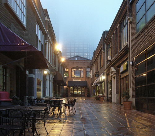
I stumbled across this delightfully human-scaled space in the middle of the variously anonymous and flashy bank towers of uptown Charlotte:

Brevard Court and Latta Arcade together provide homes for dozens of tiny businesses — Latta is divided into miniature, 500 sq. ft. bays — along a through-block passage off Tryon Street, Charlotte’s main drag. A preservation easement over the site protects it in perpetuity, even if the current tenanting plan seems a little uninspired. (Most everything was shut at 5 PM, and a few forgettable fast food chains visually dominate the space.)

Closer to home, in supposedly preservation-obsessed Oak Park, a place similar in size and scale to Latta — Westgate, a picturesque (“storybook style”) parking-court ensemble of two-story Tudor facades just half a block behind the main drag of Lake Street — is about to get summarily wiped away after 75 years. A series of insensitive developments gradually walled Westgate off from the rest of downtown: the 1950s filling in of an open-air arcade to Lake Street (the building in yellow, Tudor on the back and Deco in the front), and the botched 1990s tilt-up retail complex that “revitalized” Harlem at the expense of the town around it.

Here it is today, still mostly intact.

Of course, the same quest that led to the Harlem buildings getting wiped away in favor of hopelessly bland chain retailers in forgettable strip-mall brick boxes has come back with a vengeance. Vince Michaels has an overview of the process that led — even after an official commission heard from several professionals who urged its salvation — to the village’s announcement of an RFP to bulldoze half of what remains at Westgate and replace it with what’s optimistically termed “transit oriented mixed-use infill.” The village’s RFP only said “encouraged” teams to “investigate” saving “some of the facades.” This week, the only RFP responses selected to proceed all declined this “encouragement” in favor of teardown.

6. Historic Preservation: The Oak Park Historic Preservation Commission has indicated a preference for saving some of the facades of the Westgate buildings on the RFQ parcels and integrating them into the design of a redevelopment project. Teams are encouraged to investigate this possibility as part of their preliminary plan submittal — especially if it helps with the LEED Certification Process…

And here’s an overview of the RFP parcels (in red).

Now, I’m no reflexive NIMBY — I got excommunicated by my neighborhood association for speaking in favor of a giant condo literally in my backyard, and I’m also obviously a fan of human-scale hotels and big box retailers (what the proposals, well, propose) — but really. When you have something this exquisitely human scaled, sitting in an enviable location next to a major transit hub in an upscale area, and surrounded by underutilized land, you can make it work — by demolishing the throwaway retail boxes and parking lots at the heavily trafficked edges of the block, not the historic ensemble in the center.

Socialist baseball

Hooray! A local group, For Fans Sake, is attempting to socialize the Cubs. Well, not really, but they’re offering shares in a company that would replicate the community ownership model behind the Green Bay Packers, instead of selling the franchise to some random egomaniac billionaire. From their FAQ:

How much money can I make on this?

None.

Un-American!

EDIT: Okay, when I wrote that, I was thinking “social ownership of the means of production,” not “welfare state,” as in “corporate welfare subsidiaries to benefit billionaires” — like the wastrel governor maneuvering to buy the stadium, thereby removing a potential liability from the team’s balance sheet as its ownership shifts from one billionaire’s pocket to another.

Every step of the tomato’s way

Andrew Martin in the New York Times notices a new study that adds a few wrinkles to the locavores’ “local is better” equation with food. As with any simple equation that attempts to summarize an endlessly complex system, it has nuances.

Gail Feenstra, a food system analyst at the [University of California at] Davis campus, says her group hopes the research will help consumers decide if buying local is better than buying organic food that has traveled hundreds of miles. “Maybe you can buy organic within a certain geographic range, and outside of that the trade-offs won’t work anymore,” Ms. Feenstra said.

At some point, the ethical maze can make you dizzy. But there was one line of inquiry from the California researchers that hit particularly close to home: the carbon impact of shoppers themselves.

Some people walk or take the subway to buy their groceries and then compost what they don’t use. But, let’s face it, most of us drive and toss the leftovers into the garbage disposal or the garbage can. In doing so, we may be contributing nearly a quarter of the greenhouse gases associated with our food, research has shown.

Here’s why: Instead of going to the grocery store once a week and stocking up, many consumers are driving for groceries several times a week, if not every day, to all sorts of different stores.

(BTW, UC Davis makes olive oil from street trees on campus. How cool is that?)

Pick up and go [updated]

[I’ll be traveling for the latter half of December, perhaps without benefit of computer or phone! The horrors!]

A few assorted things from the past few weeks of being away:

* “If I lived 17.5 miles from work, I wouldn’t bike to work, either — I’d move. Remember, location and locomotion are two halves of an equation where neither is constant.” [posted at updated metrorider link]

Todd Litman calculates that every nonmotorized (active) trip displaces about seven vehicle miles traveled — not because active trips are seven miles long, but because they’re associated with smarter patterns of development.

“Not every walking or cycling trip causes seven miles of reduced driving. The lower vehicle mileage in cities with relatively high nonmotorized mode split reflects various land use and transport system factors, such as density, mix, street design, parking supply, and pricing which affect the relative attractiveness of motorized and nonmotorized travel. But programs that increase nonmotorized travel tend to create such communities, which is to say that smart growth supports nonmotorized travel and nonmotorized travel supports smart growth.”

* The Pacific Northwest spends more on oil and gas — 100% of which is imported — than on public K-12 education in 2006 or hospital care, and more than 3.5 times total spending on prescription drugs. [Sightline Institute] All that goes “up in smoke,” as they say. Interestingly, Idaho is separated on that counter — an interesting point of comparison, since as many people live within 10 miles of my house than in all of Idaho.

* An interesting “List of Privilege Lists” — ways of “unpacking the invisible knapsack” that accompany those of us with unspoken social privileges, whether racial, sexual, class, religious, gendered, or ability.

* Jay Mouawad in the Times notices that the oil producers fear the geo-green agenda:

“What we are worried about is for industrialized countries to use climate policy as a pretext to discriminate against oil,” [said Mohammad al-Sabban, a senior Saudi government adviser on climate change].

Over in the UK, $100/bbl oil has led gasoline across the magic 1.00 line: one pound per litre. That translates to about $9.50 a gallon, so really, quit whining about gas prices in America already.

* While in Toronto, I picked up a brochure distributed by Alphabet City — not the Chicago Humanities Festival, not an academic symposium, but rather something in between — outlining a program of events around local food in the Toronto area. (Ongoing online discussion hosted by the Walrus.) It opened up first to a manifesto (er, open letter) that posits food distribution as another problem of internalized profits and socialized costs, principally because “healthier, tastier” food is not necessarily more profitable. Indeed, it’s often less so. As such, it calls for market intervention and political action:

Ontario’s working landscapes, farms, rural communities, and cities are linked in a web of complex exchanges. But our food policies to date have usually ignored that web, dividing rather than connecting. If we are going to build a healthy and sustainable village, we have to make the connections… [W]e believe that food is connected to every major problem being raised in the current provincial election campaign—rising medical costs, poverty and hunger, declining farm incomes, the paving-over of farmland, wildlife protection, urban sprawl, youth unemployment, and communities at risk.

These problems will only be solved when we connect the dots.

Local farmers markets, community and school gardens, food co-ops, urban gardens, food access centres—all of these emerging possibilities support healthier, tastier food for all villagers. As this happens, everyone benefits and communities become stronger and more inclusive.

Streets everywhere, but no strolls in sight

Chris Leinberger’s new Footloose and Fancy Free “Field Survey of Walkable Urban Places” study isn’t exactly of the highest scientific caliber: I won’t begin listing his omissions, since that’d be tiring; and I personally prize a “streetcar urbanism” of continuously enjoyable expanses of urban fabric rather than periodic episodes of frenzied activity focused around rapid-transit nodes. However, it does try to put some background behind one curious observation about LA: “there are 10 million people who have, between them, maybe five places to go for a Sunday walk.” Therefore, those five places (now up to 15, by Leinberger’s rather more lenient definition) are absolutely thronged with crowds (1.13 million Southern Californians apiece, by his calculation).

His most interesting conclusion:

If the bottom 10 metropolitan areas developed as many walkable urban places on a per capita basis as the top 10 have done to date, there would be approximately 40 additional walkable urban places developed in these metro areas, probably representing tens of billions of dollars of real estate development.

Some worry that such developments appeal only to a small slice of the population — and that the market for retail of this variety is especially thin — and therefore that cannibalization will inevitably occur when new developments attempt to create walkable places. However, the demand is apparently quite a bit deeper than skeptics suspect; if demand warrants at least one walkable place per 500,000 residents (and the D.C. area apparently supports twice that level), then, say, the Twin Cities could support six or seven such places — far above the three in existence today.

Post-collegiate in extremis


young and restless Originally uploaded by Payton Chung

The first set of charts, graphs, and illustrations has come back from the planners examining Wicker Park & Bucktown on behalf of we, the people of WP-B (or at least our special service area). The most astonishing finding, in my view, is here: our neighborhood’s people are defined by a stunning — indeed, almost statistically improbable — self-segregation of young people.

Nearly 52% of the population is between 20-39, compared to just 29% nationally. 45.4% even fall within that most marketer-coveted of all age groups, the 18-35s. Maybe we could make a lot of money selling sidewalk billboards.

Perhaps even more quizzically, young men significantly outnumber young women in most age brackets: 9.4% (nearly one in ten!) neighborhood residents are (like me) men in their late 20s, nearly three times the share in the American populace. It’s not even an appreciably gay neighborhood, either.

Almost all other age groups are underrepresented (relative to their national shares) in the neighborhood by about 30-50% — except for preschool aged children. Sure enough, the kids leave at school age — although not nearly to the “total” extent that is sometimes claimed by alarmists. Why, there are about as many grade-schoolers living here as 60-somethings.

(Produced by Interface Studio for Wicker Park Bucktown Special Service Area #33)

Share the road

Okay, it’s official. If God (well, the Pontifical Council for the Pastoral Care of Migrants and Itinerant People) says so, it must be true. A new statement, “Guidelines for the Pastoral Care of the Road,” issued by the Vatican on 19 June:

V. The Christian virtue of drivers and their “Ten Commandments”

49. Back in 1956 Pope Pius XII exhorted motorists: “Do not forget to respect other road users, be courteous and fair with other drivers and pedestrians and show them your obliging nature. Pride yourselves in being able to master an often natural impatience, in sometimes sacrificing a little of your sense of honour so that the courteousness that is a sign of true charity may prevail. Not only will you thus be able to avoid unpleasant accidents, but you will also help to make the car a more useful tool for yourselves and others that is capable of giving you a more genuine pleasure” […]

61. In any case, with the request for motorists to exercise virtue, we
have drawn up a special “decalogue” for them, in analogy with the
Lord’s Ten Commandments. These are stated here below, as indications,
considering that they may also be formulated differently.

I. You shall not kill.
II. The road shall be for you a means of communion between people and
not of mortal harm.
III. Courtesy, uprightness and prudence will help you deal with
unforeseen events.
IV Be charitable and help your neighbour in need, especially victims
of accidents.
V. Cars shall not be for you an expression of power and domination,
and an occasion of sin.
VI. Charitably convince the young and not so young not to drive when
they are not in a fitting condition to do so.
VII. Support the families of accident victims.
VIII. Bring guilty motorists and their victims together, at the
appropriate time, so that they can undergo the liberating experience
of forgiveness.
IX. On the road, protect the more vulnerable party.
X. Feel responsible towards others.