Testimony on Clean Energy DC Act

My name is Payton Chung, I live in Southwest Waterfront in Ward 6, and I am testifying with regard to the Clean Energy DC Omnibus Amendment Act of 2018. I am also a board member of the District of Columbia chapter of the Sierra Club, which has heartily applauded this bill, and an editor for Greater Greater Washington.

I’m a homeowner in a vulnerable location, just a few meters above the rising tides in the Anacostia and Potomac rivers. Some of my neighbors live in houses that are over 200 years old, which have made it this far, but whose survival in coming decades depends upon the passage of this bill and others like it.

The past few years of weird weather have given us a small taste of what a destabilized climate means for DC. So-called “business as usual” carbon emissions are a misnomer, as they will ensure that business will soon become very un-usual. Instead, businesses need the certainty of knowing that emissions will decline, and therefore that their business can indeed proceed as usual.

Passage of this bill will also cement DC’s position as a leader in green business development. We are the nation’s undisputed champion in the green and energy-efficient building sector, with more buildings certified under the Leadership in Energy and Environmental Design (LEED) or Energy Star rating systems per capita than any other U.S. city. Green building professionals like myself (a LEED accredited professional in neighborhood development) have risen to the challenge set by DC’s high standards for building energy efficiency, and are capable of helping DC achieve the even more rigorous standards included in this bill. By expanding the SETF and Green Bank, this bill also ensures that all Washingtonians can implement these advanced technologies.

Passage of this bill will also boost expand DC’s already substantial “green dividend” – the economic gains we see from the fact that DC residents spend relatively little on fossil fuel imports, and therefore spend more with DC businesses. Since DC does not produce oil or gas, every dollar spent on these fuels vanishes from our local economy in a puff of smoke. Increasing energy efficiency for our buildings and transportation network directly lowers operating costs, saving businesses and residents money and keeping dollars within DC.

Thank you for the opportunity to testify in favor of the Clean Energy DC Omnibus Amendment Act.

Q&A about DC’s gas tax

Nature's fuel

Who wouldn’t be happy about Mother Nature’s Fuel?

How is DC’s current gas tax computed?

It’s 8% on the wholesale price per gallon… with a floor of $2.94, so that the revenue doesn’t drop below the prior rate of $0.235 per gallon. Since 2015, the gas tax rate has been at that floor.

It’s levied at the same rate on a variety of fuels, including ” including gasoline, diesel fuel, benzol, benzene, naphtha, kerosene, heating oils, [and] all liquified petroleum gases.”

Why did DC change how its gas tax is computed?

Here’s some background from DCFPI about why that changed. Maryland and Virginia also shifted to a percentage basis around the same time.

When did the gas tax computation change?

It was Phil Mendelson’s idea, and it was implemented rather quickly:
– May 21, 2013 headline in the Post: “D.C. council chairman seeks shift in collecting fuel taxes.”
– May 22, 2013 headline: “D.C. Council agrees to scrap per-gallon gas tax in favor of levy on wholesale fuel.”

How else could the gas tax be computed?

Here’s one goofy idea: Burning a gallon of gas produces 19.64 pounds of carbon dioxide. One could thus levy “a motor fuels tax of $0.0133 per pound of carbon dioxide emissions that result from the fuel’s combustion,” which would result in a tax of:
– $0.235/gallon for gasoline with 10% ethanol (the usual mix around here)
– $0.261/gallon for pure gasoline (usually only sold as marine fuel around here)
– $0.298/gallon for pure diesel
– $0.276/gallon for pure biodiesel
Doing so would technically put a “carbon tax” on the books without appreciably raising existing tax rates, and providing a very small incentive for biofuels.

Of course, a recalculation is also an opportunity to harmonize rates with a neighboring jurisdiction… see below.

(Interesting fact: British Columbia applies its carbon tax to fuels on a per-liter basis.)

How does DC’s gas tax rate compare to its neighbors’?

Maryland’s current rate is equivalent to $0.335 per gallon. (Yes, that’s $0.10 higher than DC’s.) Virginia’s current rate is $0.162.

How might DC gas station owners react to an increased gas tax?

You’ll have to ask them, but I was struck by this passage in a 2011 CityPaper profile (by Christine McDonald) of Joe Mamo, who owns nearly half of DC’s gas stations:

“We are really a real estate company,” he says. “We’re in it for the real estate.” Mamo considers the coming transition inevitable, given the high cost of D.C. real estate and predictions about “peak oil,” alternative fuels, and electric cars that might eventually make gas stations obsolete. “Long term, the real estate is where the value is,” he says.

Smart growth and your Sierra Club local

Taking refuge
In California, trees hug you

I was recently updating the DC Sierra Club chapter’s web page on smart growth, on which I’ve added a few links to resources about the Club and Chapter’s heritage of smart growth advocacy. Even I was surprised at how thoroughly the Club’s key policies embrace smart growth.

The overarching “Sierra Club Strategic Plan Overarching Visionary Goals” document lists as two of its 21 strategies:

Maximize energy efficiency across all sectors, including transportation, urban design, and land use. […]

Protect our air, water, land, and communities from pollution. Promote environmentally sensitive land use and urban design to minimize sprawl, provide a healthy environment for all, and minimize resource use.

Interestingly, the strategy that calls to “Protect and restore wildlands and waterways” continues that those wildlands serve a specific, objective, quantifiable purpose: “to provide large and connected habitats.” Not to protect the favorite views of favored humans, or to protect property values for landowners, but to rescue non-human species from the threat of habitat fragmentation.

The Club’s Infill Policy, adopted in May 2019, is unequivocal:

An essential strategy for reducing urban related carbon emissions is supporting dense, mixed-use communities and land uses that prioritize walking, biking or transit to meet daily transportation needs, as well as balancing jobs and housing within the region. If we make communities not only dense, but inclusive, then fewer people will have to drive till they qualify for housing financing, saving even more emissions.

Development should be dense, inclusive, and located within or connected to existing communities and neighborhoods…

Development areas served by public transportation, shared transportation, public infrastructure (wastewater, water, roads, etc.) should be zoned for dense/multi-family/mixed use development in order to reduce emissions and waste. New areas should not be zoned for exclusively single family housing only.

Development should be allowed at the highest densities within walking and bicycling distance of transit stations.

Regulations and public incentives should expand housing choices in neighborhoods that offer access to educational and economic opportunity.

The Policy on Urban Environment, adopted by the board in 1986, states (emphasis added):

…the Sierra Club urges planning and policies which stimulate…
Infill” residential and commercial development on unused or under-used land within city boundaries…
Preservation and revitalization of urban neighborhoods, with residents protected from unreasonable economic and physical disruption…
Attractive, compact and efficient urban areas; with densities and mixtures of uses that encourage walking and transit use, and encourage more efficient use of private autos in balance with other transportation modes…
These development patterns and transit improvements would conserve energy, water, land and building materials while enhancing the pleasure and safety of urban life and reducing travel distances.

The Transportation Policy, adopted in 1994, supports policy and systems that “encourage land uses that minimize travel requirements; strengthen local communities, towns and urban centers.”

The broad Energy Resources Policy (PDF) directly refers to smart growth and transit. In section VII.A.3:

Reduce the need to drive passenger vehicles by shortening the distance between workplace, home, shopping and school, using “smart growth” planning and improved transportation options. Provide safe and appealing options for walking, bicycling and mass transit, including light rail passenger trains, which will reduce vehicle trips, emissions, fuel consumption, and the demand for new roads and pavement. Well-designed mixed-use communities create long-term reductions in energy usage. Appropriately designed public transportation systems are an essential component of a sustainable energy society… Congestion pricing should be applied, when feasible. Parking costs should be efficiently and conveniently unbundled to give consumers and employees more control over how they choose to spend their money.

If your local Sierra Club entity is proving unnecessarily obtuse in not living up to these policies, I’d suggest engaging by appealing to the Club’s strong sense of tradition, deference to higher authorities (encoded in the “One Club” policy), broader principles, and yes, policies. One specific idea: ask them to review the “Guidelines Governing Decisions on Schools, Hospitals or Other Projects Serving Economically Disadvantaged Communities.” Those require specific steps before Club entities decide to oppose or endorse a public facility, with a specific mention of “low-income housing project” (and thus many large-scale infill developments subject to inclusionary requirements). Notably, the Club must have a face-to-face listening session with those who will benefit, and write a 2-page assessment of the proposal and “any feasible environmentally superior alternatives” — which cannot include displacing housing to sprawling locations. Even where opposition by the Club may very well be warranted, the policy requires that it be thoughtful and considered, rather than knee-jerk.

Deck chairs on a sinking beach

I was pondering the testimony I delivered last May to the HPRB:

Where it all began

The original boundary stone at Jones Point.

Global warming poses a grave and imminent threat to not only humanity’s future, but to our shared past as well. In a recent issue of Preservation magazine, National Trust for Historic Preservation president Stephanie Meeks wrote that “as preservationists, it is incumbent on us to reckon with climate change bravely.” If left unchecked, the higher sea levels caused by global warming threaten the very existence of countless historic structures within the District of Columbia, including a great many of the surviving structures from its earliest days. For example, the original cornerstone of the District of Columbia (at Jones Point in Alexandria) was originally constructed on dry ground — but now sits below today’s sea level, hidden by an obtrusive concrete seawall and visible only through a protective cover. From the Jefferson Memorial to Randall School, Mayfair Mansions to Tingey House, global warming could very well obliterate scores of DC landmarks.

(The HPRB approved the application that day, and the building is moving towards construction this year.)

The sad thing about my statement today? Global warming will go pretty much unchecked under the present policy regime. Points-of-no-return are rapidly approaching for the terrestrial ice sheets of Greenland and West Antarctica; even with the boom in clean energy technology, there’s no stopping sea level from rising several meters or even many meters. Ten feet, twenty feet seem matter of course now; hundreds of feet is within the realm of possibility.

Is everything that we’re fighting about within our low-lying cities about to go for naught — are we just rearranging deck chairs on the Titanic?

As Ian Urbina noted in the Times in November, property sales in flood-prone coastal areas are already slowing suspiciously. It’s impossible to know exactly why, but the rising incidence and cost of even “nuisance” flooding (as extensively reported by Ryan McNeill, Deborah J. Nelson and Duff Wilson from Reuters last year might well be causing people to think twice about purchasing in flood-prone areas.

What happens when the defenses start to run out? Will land suddenly, or gradually, become worthless? One fascinating “natural” experiment to watch is in Palm Springs, where the Desert Sun’s Rosalie Murphy wrote about the consequences of the expiring land leases that underlie half of that city. Condos are going begging for buyers, since expiring land leases can’t be encumbered with fresh mortgages — but commercial development often continues apace, since the mortgage terms are shorter.

I appreciate that the Trust is thinking more intersectionally, to the point of reframing its work as “reurbanism.” But given the forecasts, it’s tough for me not to see a lot of local skirmishes over waterfront sites as pretty pointless.

McMillan isn’t next to Metro, which is less of a problem than you think

McMillan Reservoir

You can see the Capitol Dome from here. Photo by Eric Fidler, via Flickr

Yes, the McMillan Sand Filtration Site is one mile (from either end of the site) to the Red Line. It’s even 0.6 miles to the nearest express bus route (Georgia Avenue’s 79), and key network improvements are still in the planning stages. Yet from the point of view of someone who wants to reduce auto dependence (and the concomitant pollution, injury, and sprawl), what matters most is that MSFS is close to downtown, rather than close to Metro.

Transportation planning research has consistently shown that location relative to downtown and to other land uses is far more closely associated with the amount of driving than location relative to transit. Ewing and Cervero’s definitive 2010 meta-analysis (cited by 679 other scholarly articles) examined over 200 other studies, then combined the correlations found by 62 different studies:

Yes, it turns out that the number of miles that people drive is four-and-a-half times as closely correlated with the distance to downtown than with the distance to a transit stop. This strong relationship between driving and distance to downtown is borne out in local survey research by MWCOG/TPB. Note that whether an area has Metro access (like Largo or White Flint, vs. the Purple Line corridor) doesn’t actually seem to impact the number of drive-alone (SOV) trips.

Some suggest that development proposed for this site should instead go elsewhere. If the development is denied, those residents and employees and shoppers won’t just disappear, they’ll just go somewhere else. They won’t go to superior locations even closer to downtown and Metro (because those are so very plentiful!), but rather to far inferior locations. For instance, the life-sciences employers might choose an alternative location within our region that has already approved a similar mix of uses — such as Viva White Oak, Inova Fairfax, Great Seneca Science Corridor, and University Center in Ashburn, all of which are much further from both downtown and Metro.

This isn’t just the suburbs’ fault. Within the District, even more intensive development than what’s proposed at MSFS has already been given the go-ahead at locations such as the Armed Forces Retirement Home, Hecht Warehouse, and Buzzard Point. All of those sites are also inferior to MSFS from the standpoint of not just transit accessibility and distance to Metro Center, but also on all of the other factors shown to reduce VMT.

If the “Reasonable Development” types truly do care about reducing driving, I must have missed their years of caterwauling over the approval of all these other sites — not to mention the countless suburban developments that together pave over 100 acres of open space every single day in the Chesapeake Bay watershed. That’s why I give more credence to the people who do actually care about paving over the region, like the Piedmont Environmental Council — a/k/a the Coalition for Smarter Growth.

Friday photo: Build in town, not edge towns, to cut carbon

edge town

The results are definitively in: when it comes to cutting carbon pollution from new development, location is far and away the most important factor. Even bad infill development will easily beat even the best greenfield design in terms of avoiding car trips — the single most climate-damaging activity in most Americans’ daily lives.

Kaid Benfield illustrates the point by contrasting the VMT per capita within some of the best suburban and urban neighborhood designs of recent years. Grounding his analysis in research, he writes:

[L]ocation is by far the most significant indicator of how much driving typically takes place to and from a given neighborhood. This is because of something called “destination accessibility”: outlying locations have fewer jobs, shopping opportunities, schools and other typical trip destinations within easy reach than do more central locations, causing average driving distances to be longer. (It is also generally easier in more central locations to substitute transit and walking for what would otherwise be driving trips, but such “mode shifts” are statistically less significant to vehicle miles traveled than are driving trip distances.) As a result, carbon emissions from outlying locations, per person and per household, tend to be higher – typically a lot higher – than those from closer-in locations.

It takes a lot of effort to create new “connected, complete communities” from scratch, since a “complete community” depends upon a myriad of services. When the first household arrives in an incomplete “edge town” (like Kitts Creek, shown above), they may be able to walk to other houses and some services. New services won’t arrive until there’s sufficient population to support them — and in many cases, rely upon people living even further out. Contrast that with a new house within an existing “complete community,” which already has all of that community’s services at their doorstep, from day one.

I’ll note that mode shift is less statistically significant because, outside of a few urban cores where destinations are so close by that walking is enjoyable and driving a pain, driving accounts for a substantial majority of Americans’ trips. That makes development within those few urban cores that much more important, in the scheme of shifting Americans away from automobility.

Thus, the most effective land use tool that urban planners have to address the global warming crisis — and at minimal public cost, to boot — is to make infill development easier.

Applied on a global scale (or even at a citywide scale), the potential is vast: 2014’s New Climate Economy report estimated that “compact, transit-oriented cities” could keep 1.8 billion tons (CO2 equivalent) of global warming pollution out of the air annually by 2050. That’s equivalent to decarbonizing the entire US transportation sector, or the economies of Russia or India.

Friday photo: The first sprouts in a freshly plowed field will be weeds

Country road again

An ecological analogy for retail:

Many of the plants we call weeds originally evolved in tough conditions, where there is annual glaciation, periodic flooding, or severe fires – extreme events that leave exposed, bare earth. It’s in these devastated conditions that our weeds are at home. They germinate first and grow the fastest. And through these characteristics they have found important roles in re-establishing healthy ecosystems… Once the weeds are established, longer-lived plants, less adapted to disturbance, germinate and the process of succession begins. The process may end in a grasslands, woodlands or forest, depending on the soil and climate. Indeed, the weeds create the conditions of their own inevitable demise – inevitable unless of course the disturbance recurs.

The “weedy species” that so many bemoan, the token dry-cleaners and fast-food joints that sprout in brand-new buildings, are one key to building a retail market. Over time, better adapted shops will take root — and given enough stability, species will evolve into very specific ecological niches. These new species will both adapt to their environment, and also change the environment around them. The key is to give the habitat time to evolve by avoiding excessive disturbance — a condition ecologists call “disclimax.”

Cultivating biodiversity requires striking the right balance between stability and renewal. The goal should be less to conserve individuals than to maintain the health of overall communities, to not seek out stasis forever but to manage change for the long term.

Gradual change within human communities also helps to sustain and build linkages, according to a paper by sociologist Katherine King: “A gradual pace of redevelopment resulting in historical diversity of housing significantly predicts social relations.”

Friday photo: Bonsai, artificial limits to growth, and humility

Phipps: bonsai since 1960

Cities are living things that require supporting infrastructure: physical infrastructure, social infrastructure, green infrastructure. They also need room to grow and change.

The exception that proves the rule are bonsai, “the most unnatural nature that exists,” and “like a verb…. not a noun — it’s doing.” Trees can survive when confined to tiny boxes that constrain their growth. This 55-year-old Scotch Pine at the Phipps Conservatory would, on a managed plantation, have a trunk one foot wide — wider than the magazine at right, about half the diameter of the planter this tree lives in — and be 60-80′ tall.

However, bonsai require a lot of care and feeding just to survive, including extensive pruning to thwart natural growth instincts. Without that pruning, the tree gradually consumes all of the soil’s nutrients and starves. All this intervention turns what should be a robust, independent tree into a fragile hothouse flower, subsisting on life support. At this juncture, even if it was freed from its constraints, this tree could never match the size of its wild counterpart. It’s a neat inversion of the usual relationship between man and nature, but like seeing a bored tiger at a zoo, it’s also a bit sad to see.

Natural systems also impose limits on their own sustainable growth, of course. Cycles see growth culminating in decline and death, then renewal and evolution. But nothing that’s alive stands perfectly still.

Those who propose to stop growth should have the humility to acknowledge that doing so will change the very nature of growing things. By giving themselves free rein to change the city, they are placing a tremendous burden on the resources of future generations.

Will Mayor Bowser recommit to Sustainable DC & MoveDC?

[updated 1 April]

In a recent speech to District Department of Environment employees, Mayor Muriel Bowser offered some warm words about Sustainable DC — but fell short of a full-throated endorsement:

The decisions that we make are often, I would always say, 50 year decisions… The decisions we make around transportation options, whether we put something someplace or not — again, 50 year decisions. What is clear is that we’re making decisions right now that affect the next generation, and shape the options for the generation after that.

We have to be very careful in government about how we distribute our resources, and how we take care of the community. We inherited it, and we have to leave it better for the generations that follow us…

I inherited the past successes… I inherited some good things, and one of those good things was Sustainable DC. And so what I know Tommy [Wells] will do with me is make recommendations on all the things we should keep, all the things we should push harder on, the things we have to add, and if there are things we have to change or delete we should do that too…. I was elected for a fresh start, not a start all over, and so we want to make sure that we’re building on the successes of your hard work… and push the District even farther.

Mayor Gray leaves behind a substantial legacy of ambitious plans, particularly Sustainable DC and national award winning direct descendant Move DC. Both began with citywide public involvement, set ambitious performance goals, and have started to guide real implementation efforts that would, if continued, really advance the long process of creating a truly sustainable District.

Just to put one of those performance goals into a global perspective, Sustainable DC has twin goals of increasing the District’s population by 40% and shifting 75% of commute trips out of cars — baseline goals that MoveDC started with, and crafted an implementation strategy around. Alex Block points out that this is certainly doable, but it isn’t easy.

MoveDC capacity targets

To do so will require more than doubling transit capacity, almost tripling bike capacity, and cutting car capacity by 7%. It would avert over one milion VMT every weekday — which (with current emissions factors, which assume today’s technology) would cut 580 tons a day from DC’s carbon emissions, more than 3X as much as the reviled Capitol Power Plant puts out.

Smart growth policies like MoveDC are a fine example of acting locally while thinking globally, as these are local policies that would have global consequences. The National Research Council & TRB estimate that a national shift towards denser development — including shifting more population growth into the District from the suburbs — would cut CO2 emissions from driving by 11% by 2050, even before any change in vehicle technology. That’s 132 million metric tons of CO2 each year, an amount exceeding all coal emissions from DC, Maryland, Virginia, and West Virginia. Or, put another way, smart growth cuts driving, which could cut as much CO2 as shutting down all of our region’s coal power plants.

Of course, we will absolutely need to do both — and much more — if we’re to have any hope of avoiding a certain existential threat to DC’s future. But only smart growth and energy efficiency cut emissions over the long run, and pay for themselves in the short run.

On definitions: equitable communities, magpie infrastructure, vibrant centers, gentrification

Bellevue goes upscale

Bellevue was not one of the “suburban vibrant centers” examined for a NAIOP report on office occupancy trends.

Some recent reports left me appreciative of their aims and ends, but not exactly how they got there, and in particular with how other analyses have defined key terms.

1. The Living Community Challenge certainly provides an inspiring goal to reach for, notably in its use of elegant performance criteria that broadly require “net positive” environmental performance on site — broadly, that new developments can strive to shrink their ecological footprints to fit within their actual footprints. It also pretty seamlessly integrates the Transect throughout, and in a balanced way that sometimes rewards and sometimes penalizes both ends of the spectrum.

However, having participated in the creation of LEED for Neighborhood Developments, it’s telling that some of the same battles in that scheme have emerged within this one. Prescriptive approaches still occur throughout, and some of the personal-health ones are somewhat wishy-washy. (The emerging science of health impact assessments may have been a useful complement here.) The equity section (“petal”) has a lovely intro, but its imperatives don’t address many social criteria — affordable housing is a notable omission — and almost entirely use prescriptive standards. Another long-running debate was over the use of prerequisites in the rating scheme: It seems strange that a baseline, “Petal Community” certification can be done while ignoring a majority (four of the seven) of the petals.

I’ll be interested to learn more about the Challenge in the coming weeks, and to see how others feel about whether it’s rigorous and balanced.

2. Kriston Capps brings up Mikael Colville-Andersen’s term “magpie infrastructure” in a recent CityLab piece. Bicycle and pedestrian infrastructure, examples like the Bloomingdale Trail aside, rarely needs architects’ attention — their structure-first solutions are usually fundamentally anathema to bicyclists’ lazy inclination to not climb hills. By and large, people should be encouraged to stay at grade, and landscape architects and engineers should be entrusted with their care.

Closer to MCA’s home, the current BIG exhibit at the NBM includes Loop City (video; skip to 2:30), a proposal for an elevated rail loop around Copenhagen + Malmo. The proposal lifts up the stations so that trains decelerate on the approach and accelerate as they exit — a clever idea lifted from subways like Montreal’s. When done below-ground, this brings trains closer to the surface just where they’re needed, but when above-ground, the same approach antagonizes the energy needs of the passengers (who need to climb ever-higher escalators to get to the platforms) and the energy needs of the trains.

Another obvious flaw is that the proposal repeats the Corbu-in-Algiers mistake of thinking people would want to live in flats beneath a railway, without realizing that below-the-tracks spaces are almost always only valuable in situations (I’m thinking in Ginza, the Viaduc des Arts, or 9 de Julio) where such space is just the cheapest way of getting valuable ground-level, street frontage. Even maglevs are pretty awful to stand right underneath.

Besides, haven’t we tried grade-separation of different modes before?

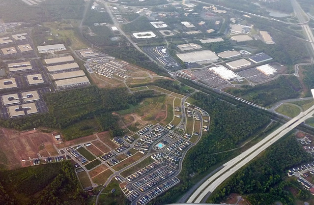
3. NAIOP recently published a report offering slight encouragement to the notion that office users are increasingly choosing mixed use environments — namely, 24-hour CBDs and 18-hour “suburban vibrant centers” (their terminology, not mine) — over single use suburban office parks. Their findings indicate that rental rates are indeed higher in CBDs, but that CBDs haven’t seen as much absorption as suburbs, whereas “vibrant” parts of suburbs had a verifiable edge in the leasing market. There’s certainly plentiful anecdotal evidence, and this has been the mantra of “Emerging Trends” and other qualitative reports for quite some time, but I’ve seen few attempts to quantitatively analyze the phenomenon.

Yet the two sets were compared quite differently. The comparison of CBDs vs. suburbs was strictly quantitative, an approach that didn’t control for the quality of the urban environments — downtown absorption was hurt by including a great many “dead” downtowns (Dayton, St. Louis, Hartford) among the comparison set. Most of the liveliest downtowns have seen strong positive absorption, since it’s less the CBD location than the mixed-use amenities that draw users.

The “vibrant centers,” on the other hand, were compared using a robust paired-case approach: single-use suburban areas were paired with mixed-use suburban areas within the same part of town. They even came up with a pretty strict definition of such centers and their comparison sites, using Walk Score and building-level maps. This better methodology dives into why people are migrating towards such sites, and goes beyond the not-terribly-nuanced submarket definitions found in typical office market reports.

Although the lower absorption figures for CBD office may look discouraging at first glance, it’s necessary to consider both that higher rents might result in tenants using CBD space more economically. Square feet don’t necessarily correspond with people, much less dollars. (Edit 26 Feb: City Observatory has a new report indicating that job growth has indeed been more robust in CBDs than in suburbs.) In addition, the supply constraints on new downtown office might suppress demand from space-hungry users — e.g., many large companies are expanding both in San Francisco and Silicon Valley, but adding more jobs in the Valley where construction isn’t limited by constraints like Prop M.

4. For good measure, here’s one instance where the methodology and the results both turned out okay: Governing’s recent analysis of gentrification at the Census tract level. The scale of the analysis is correct, the results pass the smell test, and the variables used (rankings of changes in household income and physical [home values] and cultural capital [college attainment]) seem reasonable.

A rising Potomac: oh, dam it

30m sea level rise along the Potomac

30 meters of sea level rise would wipe out most of the L’Enfant City, put the White House underwater, and leave the Capitol on a little island — but it could still be managed by damming the Potomac River at key locations, like Quantico or Mason Neck.

Of the world’s major coastal-plain cities, Washington, Rio, and London are among the few that could conceivably be saved by damming estuaries, although I’m sure the Japanese will still try. (Or maybe Houston.)

The same can’t be said for Philadelphia, where the Delaware has a very broad valley, or even New York, where dams at Verrazano Narrows and Arthur Kill will have to be supplemented by very extensive construction to block Long Island Sound. Boston either becomes an archipelago or a polder at a mere 7m of SLR. Even Montreal faces serious property loss over 20m; at 30m Beijing becomes coastal and tides could reach Lake Champlain and the Caspian sea.

Much more than 30m, like the 60m these guys have in mind, and most everything on the east coast below the fall line would be gone. Even dams at the Golden Gate and St. John’s would no longer protect San Francisco or Portland. That’s when inland real estate might become rather more valuable.

Surprisingly, my river-view apartment should be okay up to +10m or so even without a downstream barrier.

Generated using flood.firetree.net/

[Posted to Flickr on 12 June 2012, but today’s Antarctic ice sheet news reminded me that I never cross-posted it here.]

Three local leaders’ perspectives on pivoting toward sustainability

I found some quotes I’d scribbled down from a New Republic event last December (link has streamable video of the entire event) about how state and local governments are responding to climate change. The first panel, in particular, had a refreshing focus on the built environment, thanks to two remarkable mayors who truly understand the value of building sustainable communities.

Jim Brainard, Mayor of Carmel, Indiana:

“Land is inexpensive [here], so it’s easy for lenders to say, ‘let’s just build sprawl.’ But cities end up having to support all that infrastructure: for instance, it costs $7 million to upgrade a mile of road.”

“The real challenge is in the suburban development pattern areas. We threw out 10,000 years of city planning expertise… The new cities of the last 50 years frankly don’t work so well.”

On how Carmel financed the higher cost of downtown development, including structured parking: “Developers, in my experience, are quite willing to build anything they think they can make money on. We reached out very purposefully to the lending community, brought them into the discussion. It got a lot easier [once they realized that] you can borrow against that added [capital] cost, because it adds value in the end.” (Here’s a photo tour of downtown and some new neighborhoods; as with a lot of greenfield NU, the architecture could be better, but at least the urban design is well-informed.)

Bob Dixson, Mayor of Greensburg, Kansas — a gem of a speaker who seriously deserves to be on the lecture circuit.

Reframing sustainability: “The right, prudent, and responsible thing to do for future generations, so that future generations can experience the same great nation that we have.”

“Are you a renter of your community or an owner? Will someone else take care if it for you or will you step up and volunteer? Are we going to own our issues or just rent them, and expect Pennsylvania Avenue to take care of it?”

“We can get back to being front porch people and have true conversations. The best way to prepare for a disaster is to have conversations and community.”

“We had all those [standard engineering] manuals in city hall, but then the wind came and blew all those manuals away.”

Bill Ritter, Former Governor of Colorado and Director, Center for the New Energy Economy, Colorado State University

“The people of the West actually favor the EPA, it’s just that their representatives don’t.”

“Vast pools of private capital are waiting on the sidelines because of policy uncertainty. Putting a price on coal at the state level will create certainty, but instead [Congress] will keep debating it and create more uncertainty.”

“I don’t think that a lawsuit is a constructive thing against Kentucky. Are there coal lessons to be learned from other [rural] transition economies, like tobacco?”

Perhaps big changes to utility regulations are easier than small ones: ” ‘We don’t want to work against you, utilities, we want to work with you.’ Could public[ly owned] utilities lead the way? We need to redesign how we rate-base those things that you want us to do.”