Nurturing innovation

This month’s “urban issue” of FP features Margaret O’Mara warning that “you can’t build a new Silicon Valley just anywhere.” I was immediately reminded of one of the countless SV replicas out there, the Hong Kong Science Park:

Hong Kong Science Park

As O’Mara writes, “It turns out that sparkling facilities alone aren’t enough to create a high-tech ecosystem. The essential error is in thinking that Silicon Valley can be packaged into ‘innovation in a box’ that you can simply build overnight, unconnected to its surroundings, to the culture, to a moment in history.” That success has much more to do with freeing and feeding human capital than with creating a tidy physical setting.

Broad government policy can indeed nurture an innovation culture — witness the Research Triangle — but the manicured office park really has little to do with it. Creating Research Triangle Park (an initiative usually credited to then-Governor Luther Hodges, but obviously involving others [full story]) was undoubtedly a far-sighted achievement for its time, and the park thrived by catalyzing existing pools of talent within the context of a fast-urbanizing area. In retrospect, it seems that RTP’s strictly separate-use 100-acre corporate campuses (the archetypal nerdistan, to use a phrase from none other than Joel Kotkin) are a relic from a time when suburban campuses were thought to be free of stress and distractions. Today, that setting seems to encourage siloization compared to a more urban, mixed-use environment like the increasingly popular NCSU Centennial Campus down the street. (Centennial was always a long-off vision while I was a campus brat, but it finally now feels sort of like a real place. Interestingly, I doubt that anyone back in the 1980s thought that having the state farmers’ market on campus would be a selling point.)

(The same FP issue also has another dreary city ranking, and Christina Larson writing about Chongqing, Chicago on the [inland] Yangtze. Except, well, it has the population of California and is adding a million people a year.)

Oh, and since I’m writing about suburban offices (and since I keep looking for this info), here’s a graph comparing American downtowns, by office space — a useful proxy for white-collar job concentration.

For blog: downtown office space

July 2010 data from Cushman & Wakefield.

Crossing the line

Metro briefs for today. (Whew, am I sick of food trucks, although I appreciate Jef Nickerson for saying what’s on my mind: “I’m not saying Food Trucks should be banned, far from it. What I would like to see is, the city thinking about ways to encourage other forms of street food, be they micro-storefronts, push carts, Food Trucks, or something else.”)

1. Chris Leinberger tries to make nice with Joel Kotkin by pointing out that the latter is stuck in the old city vs. suburb dichotomy, hung up on municipal boundaries. This is still necessary that many years after David Rusk‘s “elastic cities” hypothesis? And for a writer based in the southwest, with its highly elastic cities? I’m more inclined to chalk it up to willful ignorance.

(Since I grew up in an “elastic” city with a regional school district, all of which consisted principally of low-density sprawl that overran and embedded a few country towns, I’ve always thought this distinction was a complete canard. Of course “auto-dependent sprawl” and “walkable urbanism” can both exist in either city, suburb, town, or country. Duh.)

2. Delhi is following Singapore and writing traffic tickets based on photo evidence of infractions posted to Facebook. I typically would support measures to improve the ubiquity of traffic law enforcement, particularly as regards public safety, but this raises serious concerns about due process. I wonder how much supporting evidence would be necessary to verify that such photos haven’t been doctored: untampered EXIF data? GPS tracks showing that the car was at that location?

3. “Chicago taxpayers [will] cry” over the $11 billion that the Morgan Stanley joint venture [JV] will make over the term of the parking meter lease, according to Bloomberg’s Darrell Preston. (The JV also admits that the amount it spent on new meters amounts to a mere $40M.) Interesting that the JV is issuing what amounts to parking-meter revenue bonds — except priced as corporate bonds, not as tax-exempt municipal debt. (I’ve been saying all this time that an easier and more cost-effective way to tap into the future revenue stream would be for the city to jack the rates and issue revenue bonds. The primary reason for not doing this is that it would add debt to the city’s books, thereby lowering its credit rating — and that the proceeds from municipal bonds are subject to greater City Council scrutiny under Illinois law than the proceeds from a PPP. Well, the city got a downgrade anyways.)

Meanwhile, of course, San Francisco — which pioneered parking meter revenue bonds back in 1994 — has just launched SFpark, its municipally run advanced market-pricing scheme. The startup costs are underwritten via a loan from the MPO, interestingly, to be paid back with the enhanced revenues. And guess what else? The city still retains the flexibility to do cool things with its public space, like curbside bike parking. Imagine that!

4. An interesting participation exercise from the Next American City, sponsored by IBM’s Smarter Cities ad campaign: The Next American City Challenge on Tumblr.

5. Speaking of Tumblr, TakeMeWithYou is a WPB Make Believe project that used the “community disposable camera” model of storytelling. This was suggested as one idea for our WPB plan outreach process; glad to see that it came up with some fun results.

6. Great article by Fred Mayer on the Twin Cities (and Madison) bike economy, which he estimates at over $300M in revenues annually. One might think that the bike industry should prove to have a particularly lucrative local multiplier effect: it’s relatively light on capital and heavy on labor, and generates positive local externalities — quite unlike driving, which sucks money out of other sectors of the economy and sends almost all of its capital costs out of the local economy.

7. Park51, or the Cordoba Initiative, is obviously a local zoning matter — and as such, national Republicans have zero say. Perhaps that’s why they’re fast falling into line to “stand against the Ground Zero mosque,” since it’s completely painless: it will undoubtedly happen, and they can look like they’re doing something (paying lip service to the insane base) without actually affecting any real change. Yet watching this is frightening: for government to step in and “stop” Park51 wouldn’t just prohibit the free exercise of religion (1st Amendment) but also deprive the rightful landowners their property (5th Amendment). That this self-described “Don’t Tread on Me” crowd can show off that much contempt for personal freedoms just makes it all the more obvious that such “freedoms” only apply to their selfish selves.

8. Tom Philpott over at Grist notes that even most rural farms, much less urban farms, don’t make money. It frustrates me that so many people are so hopelessly naïve about farming’s poor economics: after the U.S. has spent trillions of dollars paving over farmland because it’s uneconomical, suddenly now farming will be profitable enough to underwrite demolition and infrastructure work to undo it all? This goes double for architects who concoct schemes featuring purpose-built “vertical ag” megastructures for agriculture (the very definition of a “factory farm”), or those positing urban farms as the solution for just about everything urban-decline related.

For instance, last year’s Re-Burbia competition finalists included exactly two approaches that comprehensively evolving suburbs through individual initiative. The rest of the schemes were a collection of inflexible (and therefore inherently unsustainable) megastructures (the sort of megalomaniacal thinking that got us into this mess of cloverleafs, malls, and McMansions), one-off tech gizmo wonder panaceas, or land-use transformations that betray a complete misunderstanding of economics (farms and wetlands are great, but they just don’t pay the rent).

As Alex Steffen (via Allison Arieff in Good) points out (and as SF Streetsblog commenters echo), it’s a folly to think that any vacant land (even in stagnant cities) should automatically be best thought of as agriculture, particularly permanently; in many cases, such land could best enhance regional sustainability (and the regional economy) if used to enhance walkability instead with more housing, retail, or workplaces. The difference between zero and ten food miles is nothing like the difference between ten and 2,000. Eliminating the first 99.5% of the food miles is easy and necessary, so let’s not obsess over the last 0.4%.

(And really, this has nothing to do with the orchard. Honest: that necessarily has to be open space of some kind.)

9. “[C]limatologists have long theorized that in a warming world, the added heat would cause more record highs and fewer record lows. The statistics suggest that is exactly what is happening. In the United States these days, about two record highs are being set for every record low, telltale evidence that amid all the random variation of weather, the trend is toward a warmer climate.” Justin Gillis [NYT]

Less serious:

10. Oh, how I’ve giggled at the now-repaired-again Milshire Ho sign. (Backup photo.) For the longest time, I just assumed it read “Wilshire.”

11. Oh, and while we’re in Logan Square, my friends’ HGTV makeover aired in June. Check this page for when it’ll re-run.

12. Not metro at all, but a recent party joke was about a theme band called “Ayn Rand Sex Scene.” Given her newfound popularity…

What I’m reading today

[This started short and got quite lengthy. Maybe I’ll break off parts later.]

1. Citywide bike sharing arrives in the Midwest this week when Nice Ride launches in Minneapolis, using Bixi technology. (I had hoped to be there for the launch, but it looks like I’ll be there in July instead.) Interesting: (1) BCBS is the lead sponsor and (2) the city is not resting on its laurels (the article finds that the communitarian Minnesota culture is the key factor); the bikeway network is due to grow by 30% this year.

2. Jeff Speck in Architect uses the same taxonomy of New Urbanist critics — which he calls Lib[ertarian], Mod[ernist], and Saint — that I incompletely delineated in an earlier study of “Additional Myths About New Urbanism.” I used right, avant-garde, and left, but the themes are the same. Nice point in his final paragraph, addressing the Saints: new urbanism is a reform movement, not a revolutionary movement. We can’t fix everything all at once since we don’t aim to; it’s incremental change, not an entirely new world order.

Which reminds me: an offhand remark by Andres Duany about how crowds of suburban teenagers can “love the city to death” — suffocating the diversity of uses and people in the Sunbelt’s few-and-far-between urban oases — has drawn a storm of the same old Saint/Mod criticisms (only this time some bloggers are taking it personally!) about NU being exclusionary, authoritarian, static, hopelessly middle-class and middle-aged and middle-brow.

The answer to such critics is the same. Reform takes time, places evolve, and diversity must be managed as it’s actually not the natural order of human ecology. The same critics enthralled with “emergent, incremental, accretive” urbanism haven’t the patience to let Kentlands’ trees grow in, don’t understand that New Urbanists seek not to take away great places but to create new places that will, in time, evolve into great ones. Or, as I’ve said before, “today’s Old Urbanism was yesteryear’s New Urbanism, and therefore that today’s New Urbanism, in due time, will be tomorrow’s Old Urbanism… time is the most necessary ingredient to create the ‘authentic urbanism’ that many critics of New Urbanism cite in false opposition to NU.” In other words, give us a hundred years.

Of course, Duany doesn’t speak for the entire movement, and his admiration for civil libertarian’s bugaboo of Singapore — which actually does a better job than the USA of guaranteeing its citizens human rights like health, housing, education, and safety, not to mention protection from rights violations — is not exactly a plea for tyranny. I disagree with Duany about democracy’s utility: not a surfeit of democracy per se, but rather a fake populism that empowers a vocal [small-c] conservative minority, has impeded urban evolution.

3. Speaking of history and democracy, Charles Siegel writes about “Unplanning” over at Planetizen, arguing to some extent that planners caused the auto domination of American cities — whereas politicians should have kept them in check. While that may be true around the margins — different cities on the same continent have chosen rather different paths towards relative auto domination, as Patrick Condon (links to PDF) points out — my own reading of history (relying on Peter Norton here) says otherwise. Auto domination was a conscious political choice made in the 1920s, before the era of professional planning (or rather, traffic engineering), by political elites who sided with affluent auto drivers in their fight to claim road space from working-class pedestrians and middle-class transit riders. Indeed, overt attempts to politically legislate exactly the slow-traffic conditions that he outlines failed miserably: a 1923 initiative in Cincinnati (placed on the ballot with 42,000 petition signatures) that would have mechanically prohibited autos from going faster than 25MPH went down to defeat after a furious campaign by the Auto Club and newspapers.

4. More history: an oral history documentation project of LA Chinatown during my grandfather’s era.

5. From The Atlantic‘s special city issue, a reminder by Benjamin Schwarz that “Manhattan never was what we think it was” — or what Village writers like Sorkin and Zukin think it was. The bohemian, deindustrializing Lower Manhattan (itself hardly static) that so many exhibit a false nostalgia for was “pretty much limited to the years of the LaGuardia administration,” and itself was quite an exception within a vast urban “agglomeration of mostly self-sufficient, inward-looking, lower-middle-class communities.” Yes, Jane Jacobs wrote convincingly about how that city worked, because she lived in it. Yet many take the wrong message away from Jacobs: the look and feel of the industrial city were just the backdrop; her principles say nothing about post-industrial gentrification. Jacobs loved watching systems emerge and evolve from market interactions; heavy-handed intervention was most certainly not her style.

Yet the paralyzed political climate that has resulted from empowered neighborhood “activists” (see above) has stunted urban evolution — always driven by markets’ creative destruction — in the name of this faux “authenticity.” These “activists” don’t realize that the problem they seek to solve isn’t with architects or planners or even with developers, it’s with “all that is solid melts into air” capitalism itself. There are ways around this, and I’m excited to see that authors like Matt Hern get this and are doing something about this: shutting down streets and setting up collectives to reclaim space, not just a setting, for society. The planners, cops, and Tories he antagonizes turn out to be mostly reasonable people, doing pretty good work within a flawed system larger than all of them. Sure, he has his share of “can’t we all just get along” platitudes, but even those are grounded in a sense of possibility and progress. Perhaps it’s due to his base outside the Greenwich Village snowglobe, in a peripheral city simultaneously tossed about by globalization, blessed with a surprising degree of autonomy, and relatively unweighted by hidebound tradition. It’s a much fresher take on “finding real place” than I found in either Zukin or Sorkin’s books.

6. More authenticity: Hong Kong, which made an interesting decision to conserve and rehabilitate one of its original public housing blocks, will now preserve Wing Lee street. It gained notoriety principally for being an actual movie set, the only place where directors could recreate a feel of 1950s tenement life.

7. Just nudging urbanism along in California could cut CO2 emissions in half — and by 75% over a business as usual scenario, according to new research by Peter Calthorpe. The household savings angle is an interesting one to push: the less people spend on cars and oil, the more they’ll have to spend on houses — preserving the property values which are so incredibly paramount to California politics. Jarvis League, are you listening?

8. “You want to know who Sarah Palin is? She’s the False Maria in Metropolis! That’s who she is.” — Peter Trachtenberg

9. The world’s thirst for oil has outpaced humans’ capacity to “safely” (if we ever could) drill for (and burn) it. Sickening pollution is intrinsic to oil; the act of driving is drilling. And as we’re finding out, drilling technology has advanced faster than spill-cleanup technology. Boycotting one company won’t help; they all have tar and blood on their hands. Alexandra Paul at HuffPo:

There is a story about a scorpion asking a frog to carry him across a river. The frog is afraid of being stung, but the scorpion reassures him that if he stung the frog, the scorpion would drown as well. So the frog agrees to be carried on the scorpion’s back across the river. Mid-river, the scorpion stings the frog, dooming the two of them. As they are sinking, the scorpion explains, “I’m a scorpion; stinging is my nature.”

Ocean drilling is the nature of oil companies. It is what they do, even if it dooms us all. We can be angry about how they are ineffectively dealing with their mess, but in the end, BP is drilling for oil in environmentally sensitive areas for one reason only: we need the oil they provide.

Axis of warmth

At a seminar this weekend, I heard from political consultant John Neffinger that “charisma = strength + warmth.” Warmth is the dimension that separates Dick Cheney from Bill Clinton — or, as I was thinking, Robert Moses from arch-nemesis Jane Jacobs. That’s the juxtaposition that makes “Boozy,” wherein Jacobs snarls and Moses tap-dances his way to success, such a brilliant inversion of history.

Anyhow, another key takeaway is that true charisma wears a peculiar expression: angrily-lidded eyes with a broad smile. (My attempt at constructing such a face sent a room into peals of laughter.)

“No recipe for urban funk”

Common Ground in a Liquid City: Essays in Defense of an Urban Future Common Ground in a Liquid City: Essays in Defense of an Urban Future by Matt Hern

This book offers a rare viewpoint: a thoughtful inner-city leftist who understands both New Urbanism and capitalism (and apportions the blame correctly), Vancouver and the world, direct action and policy prescriptions. A useful tool for focusing my own thoughts on density and diversity, and how they combine to create interesting, humane places. (Some, like architect Neal Payton*, add a third D of design, but sometimes I think that enough of the first two can counterbalance even the worst design.)

* Not my namesake, even though by strange coincidence I was named in LA, where he lives. His last name was anglicized generations ago.

Ped malls have it backwards

[sent to NextGen list, responding to Lydon]

Prime downtown shopping streets rarely work as ped-exclusive streets. 3rd Street or Lincoln Road are exceptional places on many levels: most of America is not Santa Monica or South Beach (nor Boulder, Aspen, Burlington, nor Times Square). Instead, why not focus on smaller streets with an entertainment focused tenant mix? East 4th in Cleveland (official site) actually seems to work okay (a single owner is a huge advantage), especially relative to its surroundings. Even in Europe or Asia, grand retail corridors aren’t pedestrianised (Stroget

being the exception rather than the rule); it’s the side streets, where cars always felt like a huge intrusion anyways.

Shown here is Sai Yeung Choi Street in Kowloon’s Mong Kok district, which is car-free from 4pm-midnight every night — a switch only undertaken in the past few years. As you can see, a pedestrian street is not defined by the absence of cars: it’s about the abundance of pedestrians.

Kowloon’s main spine, Nathan Road, continues apace a block west, and alleys (really, just wide enough to push a cart down) are on either side should deliveries still be necessary. Of course, the other side streets are just as choked with pedestrians — often browsing at retail stalls, as on Tung Choi Street just east, and often sharing the space with the few cars who dare to brave the streets.

Of course, having stupendously high densities helps to sustain retail on both the arterials and the side streets, and the American tendency to have fewer but larger shops certainly doesn’t help.

Insisting that shoppers will materialize out of thin air just to see a place that’s interestingly designed, but inconvenient to get to — an “if you build it, they will come” approach — is backwards. Instead, retail is all about making things easy for customers, and the converse is true: “if they come, then you build it” (a nice echo of the aphorism that “retail follows rooftops”).

This strategy kind of mirrors the suburban lifestyle center approach: the arterial is still there to handle circulation, but the inviting environment is off to the side.

A similar approach here in North America was taken on Rue Prince-Arthur in Montreal’s lively Plateau neighborhood, a pedestrian street that links two parallel main streets (St. Laurent and St. Denis).

Nuances of housing density

[h/t Kaid and Irwin Dawid/Planetizen for the video of Dan Zack’s density game]

Of course housing density is something that we must properly understand, and it’s a necessary (but insufficient) precondition for so much of what makes a great city — particularly the sustainability of services like retail and transit. However, there’s a danger in making it an end rather than a mean. So many other factors, like unit size, household size, parking ratios, landscaping, and occupancy rates (a high percentage of high-rise units are second homes) can have a huge effect on how density “lives” once it’s built.

For instance, the Cabrini-Green building shown is being replaced with three-story walkups that might have:
– the same DUA density
– higher occupancy rates
– higher impervious surface cover
– more living space per capita
– lower population density (much smaller households)
– higher income density (much higher household incomes)

Lower population density might mean lower transit ridership, but higher incomes mean that more retail space is needed.

Two leaps forward

How’d another few weeks disappear? Recent news: the Wicker Park Bucktown Master Plan, a three-year effort by WPB that I initiated and chaired the steering committee for, will receive the American Planning Association’s 2010 National Planning Excellence Award for Public Outreach. Our public outreach strategy centered on three Open Houses, designed as a fun and interactive way for residents and visitors to learn about the plan and share their ideas on their own schedule. Credit for the creative campaign that supported the Open Houses goes to Country Club Chicago for print and transit ads, and Interface Studio (our planners) for their video installation.

In an earlier post, I wrote about the potential of the PEIRurban sensing” project developed at UCLA and featured at Wired’s NextFest. Now this ubiquitous-computing strategy has found an even better vehicle, with the MIT Senseable City Lab’s Copenhagen Wheel. The customizable wheel incorporates a hub that goes far beyond three speeds: it adds ambient air quality, noise, and temperature sensors along with GPRS data and Bluetooth wireless to share that information with the network and your smartphone. What’s even better, it adds dynamic regenerative braking (with a motor, batteries, and torque sensor) — another long-held dream of mine. (Too bad their test bike looks like a ghost fixie.)

The Bluetooth connection might be an interesting way of integrating place-based rewards — a method that a shopowner could “validate” someone’s bike trip just like car-parking charges. The University of Minnesota will soon launch a program wherein frequent bike commuters with RFID tags on their bikes will get rewarded with discounts at an on-campus bike station, for example — and, if they’re employees, that benefit can come from pre-tax income under the new bike commuter benefits.

Wary of the next spatial fix

Recently was skimming Jason Hackworth’s The Neoliberal City, wherein a primary argument is that gentrification is a spatial manifestation of neoliberal urban policies. I’m not entirely convinced — if anything, the relatively minor scale of gentrification as a force shaping cities (relative to, say, deindustrialization or large-scale immigration) points to the weakness of said policies — but in any case it reminded me of what David Harvey (PDF) called the spatial fix:

capitalism’s insatiable drive to resolve its inner crisis tendencies by geographical expansion and geographical restructuring… as an example, the key role of suburbanization in the United States after 1945 in absorbing surpluses of capital and labor.

It’s rare for these various fixes to be unwound, although it has happened before — the reversion of farms to forests in the East or the abandonment of railroad ROWs could be seen as repudiations of earlier expansionary policies. More likely, these earlier fixes were just forgotten and consigned to history’s dustbin as even bigger fixes (industrial agriculture and highways) took hold. Sure enough, we see two tendencies afoot: the immediate one being bailouts. Chris Leinberger refers to “the bailout of sprawl” as massive sums go into propping up the mortgage giants: “America has overbuilt auto-oriented fringe housing well beyond what the market wants… it is quite possible that this housing stock will continue to have a market price less than replacement value, as it is the case today.”

Meanwhile, cheerleader Richard Florida celebrates the idea of a new spatial fix, one which will knit together megalopolises:

It may well be impossible for sustained recovery to come from breathing life back into the banks, auto companies, and suburban-oriented development model. A new period of geographic expansion – or what geographers term a “new spatial fix” – will eventually be needed to spur a renewed era of economic growth and development.

As much fun as this “green Keynesianism” (Mike Davis) might be — and I’m sure it will bring fantastic new job prospects to the planning sector — there’s always a danger afoot. Richard Wells reminds us that prior spatial fixes existed to solve capital’s problems, not society’s, and that they’ve always involved considerable displacement, conflict, and struggle.

Hadn’t seen the Davis article before; it’s kind of “The Emerging Democratic Majority” all over again. Nice to see that even radical critics get that, though. Here’s a cute chart:

Edit to add: here’s a fun idea for a cartogram: take this table and size the states by their total property value, and by their total home equity. Yes, indeed, Nevada would vaporize in the latter!

We do this because

A recent conversation turned, as many do, to travel — but not so much the logistics thereof, about which any flyertalker can expound for hours, but rather what it is that we’re seeking away from home. Is it better weather, time with loved ones, a tastier cup of tea, or just that weightless sensation of being lost?

It seems that I like to see the world as a laboratory of urban policies. Untangling and uncovering the layers of human interventions that result in our built environment still interests me more than even the most stunning of natural settings. We can’t understand a decision without understanding the assumptions and the context surrounding it: how the rationales made sense at its moment in space and time. Steve Mouzon likes to repeat the line “we do this because” throughout his pattern books — although that genre typically tells you how to do things and how they’ve always been done, but rarely why. Such practices are meaningless if not grounded in a place and its history.

Similarly, it always troubles (and frankly astonishes) me when I meet small-c conservatives who apparently listened when the Wizard declares, “pay no attention to that man behind the curtain!” To be blind to history, to accept that the world was evidently created just yesterday without any human intervention, to accept that the status quo shall always be such and that any attempts to change are futile, dangerous, and heavy-handed — this attitude strikes me as willful disbelief. When those with libertarian tendencies parrot this, it amounts to (to quote Sondheim) “keep the status quo permanently so!” For instance, I recently had occasion to point out that “making driving ‘as unpleasant as possible’ is no more heavy-handed an intervention than 80 years wherein government strove to make driving as pleasant & easy as possible.” A society’s attitude towards driving has nothing to do with economic freedom, either: by far the two most free economies in the world, Hong Kong and Singapore, have some of the world’s strictest policies discouraging car ownership — punitive registration taxes, high road tolls, and high gas prices. Why? Because they’re also the world’s two most densely urbanized economies, and mass car ownership — and the pollution and congestion that would ensue — would impinge on others’ freedom of movement, and damage the economy besides.

Access road
“It is amazing to go out to the end there, look around, and wonder just why they did this.” (Jack Hartray was speaking of Wacker Drive, pre-Lakeshore East, which resembled this Indiana steel-mill viaduct.)

In the past, I’d study these things more closely here in North America: it’s easier to sell an idea once it’s been tried somewhere with a substantially similar legal or cultural background. Besides, it’s also substantially easier and cheaper to get to. And yet it’s sometimes more interesting to stumble across a great public policy idea implemented amidst greater odds. It’s humbling, for instance, to see carefully built public infrastructure (like TranSantiago’s efficient prepaid bus stops) in countries much poorer than the US, land of the affluent society.

So anyways, here are some highlights from the past few months of wandering about:
– Of course, I walked The High Line in July. It was, indeed, pretty magical to be suspended over the city, but plenty enough’s been written about that.
– I’ve written about Liberties Walk [full set of photos] before, a small-scale pedestrian mall flanked with townhouses over independent shops in scruffy Northern Liberties, Philadelphia. Another, much more ambitious phase recently opened, called the Piazza at Schmidt’s, and the Walk itself has been extended two more blocks. Future phases will add more multistory buildings, notably including one building fronting Girard (an adjacent arterial) with a supermarket and parking. (That phasing strategy is notably offbeat: usually you’d lead with the supermarket anchor to build traffic and then follow up with specialty shops, but this has proceeded in exactly the opposite manner.) The architecture might seem aggressive at first glance, but its weight and massing do strike a balance between industrial buildings on the east and residential on the west. The public spaces themselves are pretty sparse, which works for the narrow Walk but not the broad Piazza. Critics have weighed in on the Piazza, notably Philly Skyline and the Inquirer’s Inga Saffron.
– I’m always intruiged to see other instances where off-street retail has been introduced to an urban neighborhood, so two examples from Santiago de Chile caught my attention: the block-sized Patio Bellavista complex on Pio Nino, and the tiny but elegant Plaza del Paseo Barrio Lastarria.

Off-Milwaukee: a bike route

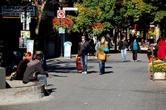
Everybody loves Milwaukee Avenue — perhaps a little too much so. It’s the city’s busiest on-street bicycle route, with a bicyclist passing through Milwaukee, North, and Damen every six seconds during rush hour. 2009 counts indicate over 3000 a day (about 22% of all vehicles) at its southern end, a number that’s boomed in recent years. Besides all these bikes, it moves 15,000 cars and buses a day, and 70,000 passengers ride alongside on the O’Hare Blue Line.

It’s certainly the most direct route between the northwest side and downtown, but sometimes we cyclists want a route that involves less door zone and more trees. So, after years of living in Ukrainian Village, Wicker Park-Bucktown, and Logan Square, here’s one set of lightly trafficked routes which get me to and from downtown with minimum fuss (and often with stoplights as it crosses arterials). It’s 36% longer than a straight shot down Milwaukee from Logan Square to Wells/Monroe (22.7km vs 16.7km) and takes about 10 minutes longer.

route map

[A zoomable, turn-by-turn route can be found at Bikely.]

The route takes advantage of a few streets around Logan Square that were platted around Milwaukee’s diagonal axis, evidently before the gridiron was enforced. It also runs along the grid through scenic Ukrainian Village and the Kinzie-Carroll-Fulton industrial corridor on the near west side. For those times when a stop on the north side is necessary, I’ve found Kingsbury and Larrabee-Geneva to be good routes.

How can these streets become even better for bikes and for their residents? One approach, popular on the West Coast (and in the WPB plan!), is called the bicycle boulevard — radically traffic-calmed side streets that are optimized for bicyclists moving at a steady 10-15 MPH. They’re the mainstay of the bikeway networks in cities like Berkeley, Portland, and Vancouver, and take full advantage of the fact that Western cities have extensive street grids with good connectivity. Although they’re a key element of Chicago’s Bike 2015 Plan, none have been implemented yet here. When they are, there’s plenty of guidance out there, like this new Bicycle Boulevard Guidebook. Local residents get calmer traffic with fewer inconveniences, cyclists get faster and better routes, and everyone wins with more safety — similar interventions in Europe have resulted in 50% reductions in injuries.

A few of the elements found along bicycle boulevards:

chicane
Traffic calming features like chicanes (twisting the path of vehicle traffic, often using planting or curbside parking) and low speed humps.

Bicycle boulevard entrance
Cut-out sleeves and other curb features allowing bikes to go two ways on a street, but restricting car traffic to one-way or altogether. (This simple feature, already implemented by Dearborn Park in the South Loop after years of effort, could make a lot of the new culs-de-sac around town much easier on bikes.)

stop
Bicycle-friendly traffic signals give cyclists and pedestrians a protected way to continue where the bike boulevard crosses arterial streets. In some cities, like Brookline, Mass. and Davis, Calif., these are embedded sensors in the street; in other cities, like Vancouver (shown above), they’re pushbuttons by the road.

This still leaves the question of how to further improve Milwaukee Avenue for the thousands of cyclists who use it every day. After investing millions into the city’s busiest bike route, the Lakefront Path, some more attention should be paid to the city’s busiest inland bike route. Many incremental, and relatively cheap, improvements would improve bikeability on this street — improving safety for all users and further encouraging cycling’s amazing growth. A few relatively low-cost but high-impact ideas:
1. Perhaps there are enough cyclists — roughly half of peak-hour traffic, by some accounts — to justify creating timing the green lights so that bikes and other traffic at 12MPH gets a “green wave.” This has also been done in Denmark, downtown Portland, and San Francisco. I can never seem to hit the green lights in sequence, regardless of my speed; enhanced signal timing could speed the trip from Logan Square to Wicker Park by 25%. The “wave” improves safety by moving cyclists through intersections, which is where where conflicts and crashes occur, and by improving compliance with the law. (The usual argument against, particularly for CMAQ funds, is that the air quality benefits of encouraging bicycling rarely cancels out the AQ impacts of stopping cars/trucks, but perhaps we’ve reached a level of cycling where the balance has tipped into the bikes’ favor.)

2. At particularly complex intersections, a Leading Pedestrian Interval could dramatically improve pedestrian and cyclist safety. An LPI gives pedestrians a three-second head start over cars at an intersection (often used by bikes, but this could also be explicit), giving peds clear priority over turning vehicles. It’s like a mini-scramble signal, and it’s incredibly effective: a test in St. Petersburg, Fla. found conflicts diminished by 95%. The six-corner intersections have lots of turning movements and thus many conflicts; they’re also perhaps not best for scrambles, since few pedestrians would wait through the entire cycle to cross the street.

3. Speaking of turns, I would suggest that the protected left-turn signal phases (which I generally dislike: there’s no right to a left turn!) follow, not lead, the green phases. (Here’s another argument for it.) In other words, the left-arrow-green should come after the green light — which is, after all, usually when people sneak a left anyways (after getting stranded in the middle of the intersection by the “left turn trap“). Also, too often it seems that the drivers waiting in the left turn lane get distracted and don’t make their turns until their protected signal phase is almost over, which wastes precious signal time for everyone; this should be less of a problem with a trailing signal phase. Apparently, this is called “lag-lag (permissive-protected) left-turn phasing” in the traffic engineering literature, and I should probably ask a few engineers about it.

The above three signaling improvements could easily be accomplished within the scope of the upcoming Milwaukee Avenue reconstruction program, or even before. Perhaps they could together be called “Greenlight Milwaukee.”

4. I was going to write something about how more radical bike lane designs could revolutionize the way the street works and looks. Rue Rachel across Montréal’s Plateau, fits a bidirectional cycletrack, two-way traffic, and parallel parking into a ROW that could easily fit inside Milwaukee Avenue with ~10′ to spare, and these streets in NYC have protected bike lanes in streets with even less space and higher traffic volumes to work with. However, such approaches are impossible until the parking-meter contract ends; there’s no way to add much new bike space (or bus space, or pedestrian space) without subtracting at least some parking spaces. Oh well. File this one for the 2083 file.

In the meantime, the WPB plan offers up schemes for reclaiming excess road space at key intersections, which would slow down car traffic and make pedestrian crossings shorter and safer.

5. A while ago, I thought I saw a schematic plan for Logan Square which showed narrower roads, fewer crossings, and tighter curb radii, but I can’t seem to find it. It’s crazy that crossing the square requires crossing 20 lanes of 50MPH traffic at six different lights. There’s no reason whatsoever for the two-lane roads approaching the square to become four or six lanes through the square; the excess pavement could be returned as green space. In the future, the urban-fabric wounds left by the subway tunnel (the space over the portal, the principal subway entrance and the huge blank wall behind it, the underutilized former terminal [now Banco Popular and its parking lot], and the bus terminal) can be healed with new buildings or public amenities.

(All photos mine.)

Smarter shuttles for Silicon Valley

The rise of Silicon Valley employee shuttles has been much covered by the press — with some finding solace in the fact that they grant an urban, car-light lifestyle option to formerly office-campus-bound techies. Since these are operated by private employers as an employee courtesy, they’re usually comfortable and sometimes have sophisticated IT backends that make them more demand-responsive than public transit options. A few disappointments, though:

1. They’re not quite the IT revolution we were promised, although that could certainly change. Given that all the users are well-wired (erm, well-wirelessed?) and that origins and destinations are relatively closely clustered together, this is one population that could conceivably pilot a fully demand responsive “smart jitney” system. Yet instead, fixed route buses (and all the wasted capacity they entail, especially with each company offering its own service) appear to be what even the savviest of techies are comfortable with.
2. The shuttles add even more layers of complexity to what’s already a mind-bendingly complicated transit network. I’m the sort of guy who loves figuring out puzzles, and again IT can do a lot to help sort out complex equations like “getting from A to B” — but Bay Area 511 already has to keep track of 41 different transit agencies. I remember one afternoon excursion, with two destinations, which sent me on six different agencies’ vehicles — each with different fares, transfer policies, hours of operation, whatever.
3. Their emergence really points up the failure of the last-mile solutions, in SF and particularly in the Valley. Muni is a poor crosstown solution to get to CalTrain, whose corridor is not particularly close to many trip origins. And in the Valley, auto-oriented development patterns make that last mile utterly impossible. It’s telling that (just to choose one example from biotech) Genentech’s South San Francisco facility is hidden in an office park 4000′ from a CalTrain commuter rail station, while its Cambridge University Park facility is a pleasant 1000′ walk from an MBTA rapid transit line.

In short: Silicon Valley needs to grow up at some point. Perhaps nowhere else in America is there a more clearly demonstrated need for transit-oriented development.