Recently: winning the war on sprawl, over-preservation, office to residential, shared streets, tax bill

I’ve recently published several articles over at GGWash.
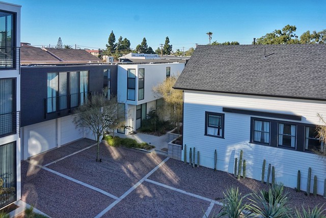
  • Sprawl is slowing, but that doesn’t have to mean higher housing prices.” The downtown high-rises under construction only tell half the story of Greater Washington’s housing growth story. While all those cranes are easy to see from afar, what isn’t immediately apparent from the airport (but might be from a plane) is that many fewer acres of the countryside around us are being bulldozed for subdivisions–which for the past century has been where most lower-cost, low-rise housing was built. As a result, the region as a whole isn’t building enough housing for our rising population… Not only is supply overall not keeping pace with demand, but a large fraction of the new supply is in the housing market’s priciest segment: expensive high-rise construction, on expensive downtown land.
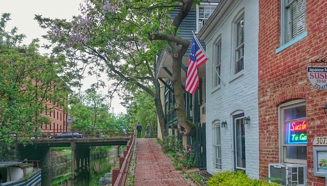
  • DC has more historic buildings than Boston, Chicago, and Philadelphia combined. Why?” Nearly one in five properties in DC are protected by local historic designation laws. DC is so prolific at handing out historic designations that we have more historic properties than the cities of Boston, Chicago, and Philadelphia combined, which together have almost eight times as many properties as DC. While this policy has ensured harmonious architecture across much of central Washington, it also means that Washingtonians are much more likely than residents of other cities to have their construction plans delayed or denied on subjective grounds by a historic review board.
  • Historic preservation in DC saves the loudest neighbors, not the finest buildings.” DC’s surfeit of historic structures results from several factors, notably the broad application of rather vague criteria for designation. As Roger Lewis has written, “the HPRB decision is inevitably a judgment call because much of the evidence for historic designation is inherently subjective.” Since every resident “squeaky wheel” is invited to request historic designation for just about any site in the District, many do — and overwhelmingly, they succeed.
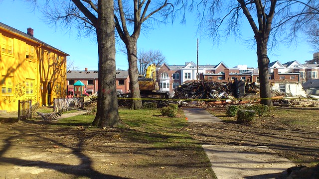
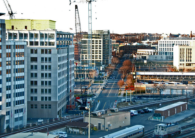
  • DC’s countless thirtysomething office buildings stare down mid-life crises.” No other region can match Greater Washington’s density of 1980s and 1990s office buildings — we built over a million cubicles’ worth, almost as many as in the much-larger New York and Los Angeles regions. Now, these buildings are facing mid-life crises; many require substantial additional investment, as key building systems (like air-conditioning, plumbing, elevators, and roofs) require overhaul or replacement, just as the office market has changed.
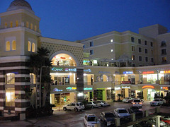
  • Not every obsolete office building is cut out to become apartments.” Some, but not all, of these old offices can become residences, depending on their location, price, and layout. Despite considerable media coverage, office conversion has been comparatively limited in greater Washington for a variety of reasons, including a relatively healthier office market and a lack of specific incentives for the practice. Residential conversion offers some promise, but will not be a panacea for either the over-supply of offices, or the under-supply of affordable homes, because not every obsolete office building can be converted to housing.
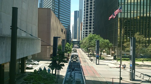
  • Metro needs a loop to lasso riders from this growing corner of DC.” The way the District is growing is creating another rail bottleneck on the other side of town that will have to be addressed in the future. The Capitol Riverfront is easily the fastest-growing part of DC right now, and by some accounts one of the fastest-growing neighborhoods in America. If all 11,978 new housing units proposed within the Capitol Riverfront get built, the area around Navy Yard station would have the largest household population of any Metro station. Metro’s ridership forecasts, which now factor in development proposals, foresee that the area’s rapid growth might require additional investments, like a new subway line.
  • How are the Wharf’s shared spaces working out?” When the Wharf opened last month, it instantly became the largest expanse of “shared space” streets in the country. Over the past few weeks, it seems like these streets are largely working as they were designed. Even though a few of our commenters were skeptical about whether the approach would work here, so far there haven’t been any major complaints or adjustments needed.
  • The GOP tax plan would make housing and infrastructure more expensive.” Eliminating Private Activity Bonds and New Markets Tax Credits, as the House GOP’s tax code overhaul proposes, would have deep ramifications for funding infrastructure and affordable homes in the region.
  • The latest Republican tax bill changes commuter benefits, but probably not yours.” Tax law will only indirectly affect most area commuters.
  • Added 26 January: “A bold California bill would ease transit oriented development. How would a similar approach affect DC?” A bill recently introduced into the California legislature boldly proposes that every transit corridor in the state be rezoned to permit mid-rise apartments. In Slate, Henry Grabar writes that it’s “just about the most radical attack on California’s [housing] affordability crisis you could imagine.” In the Boston Globe, Dante Ramos writes “the bill may be the biggest environmental boon, the best job creator, and the greatest strike against inequality that anyone’s proposed in the United States in decades.”


Friday photo: A balcony to nowhere

Twinbrook Hilton, faux John Portman

Twinbrook Hilton, Rockville, Md.

Architect John Portman was fond of putting “balconies” around the edges of his hotels’ massive atria. Perhaps this was part of the concurrent “conversation pit” trend that afflicted malls of that era, maybe people really did just pause and gawk at the tremendous volumes while walking to/fro the elevators, or maybe he liked the “columns around the Forum” look that they lend to the interior. Yet… nobody quite knows what to do with them today.

Who, after all, has need to stop and gather in a hotel hallway, the very definition of a neither-public-nor-private space? Why not go to the lobby, if it’s a public conversation, or into a room?

At the faux-Portman Twinbrook Hilton in Rockville,* the management was sick of complaints from atrium-facing rooms (one-third of the total) about nighttime noise. One option was to replace the atrium-facing windows with airport-style noise-insulating glass, but ultimately it proved cheaper to just wall off the entire atrium with a curtain-wall system – including putting these silly aluminum doors to wall off the balconies. Maybe someday they’ll put furniture out there, which surely will just gather dust. Or maybe there really are people who use these spaces, like maybe gossipy 8th graders on school trips who don’t want to keep their roommates/chaperones awake. (Isn’t that what Snapchat is for?)

Of course, that particular solution is still better than the temporary option I once spotted at the true-Portman Bonaventure, apparently aimed at LA’s exhibitionist-fitness-enthusiast crowd:

Pod people

Westin Bonaventure, Los Angeles, Calif.

* I remember once staying here as a child and getting evacuated from the building by an overnight fire alarm, in my first (but definitely not last) high-rise fire alarm experience.

Friday photos: Jane Jacobs in Georgetown


Farewell Georgetown, C&O Canal

Grace Street, between Chaia and Dog Tag Bakery

There’s one passage in Death and Life where Jane Jacobs singles out the District for praise. Not surprisingly, it’s for the back streets of Georgetown, which (of course) house some of my favorite little eateries.

In city districts that become successful or magnetic, streets are virtually never made to disappear. Quite the contrary. Where it is possible, they multiply. Thus in the Rittenhouse Square district of Philadelphia and in Georgetown in the District of Columbia, what were once back alleys down the centers of blocks have become streets with buildings fronting on them, and users using them like streets. In Philadelphia, they often include commerce.

Cady's Alley shared street

Cady’s Alley, a shared street, with Leopold’s Kafe

Georgetown passages

C&O Towpath at 31st St., with Sushi to Go. Baked & Wired, Il Canale, and Snap Cafe are around the corner.

Georgetown passages

The newly opened Sovereign lies just behind the 100% corner at Wisconsin & M, at the end of an unnamed alley. More retail is planned for the interior of this block, between M, Wisconsin, Prospect, and Potomac.

Friday photo: Shared space, residential parking-lot edition

Sofia Lofts, San Diego, CA

The ULI Case Study that I wrote about Sofia Lofts, a 17-apartment development in a neighborhood in eastern San Diego, was recently posted. I was particularly intrigued by how the developer/architects used shared space to maximize usable open space while meeting the letter of the law with regard to parking requirements:

For the balance of the 21 [parking] spaces planned, six more garages are accessed via the courtyard. The plans show seven more spaces within the courtyard itself, immediately in front of the garages — but to keep the space inviting, the spaces in the courtyard are off limits for tenant parking. It’s a small net loss for NDD, which discounts the rent for some tenants who forgo on-site parking, but results in a common area that looks like an expansive garden, rather than a parking lot.

The materials used within the courtyard were also chosen to make the garden feel like a place where cars just happen to be allowed. Part of the driveway near the alley is paved with concrete, but the center of the property is covered in pea-sized gravel. The texture of the gravel slows down cars to walking speed, adds visual and auditory interest, and permits rainwater to filter through. Its inspiration comes from a house in Italy that the Nakhshab family lived in; as Soheil recalls, “The courtyard we would always play in had that type of gravel, and we are seeing the tenants’ children doing the same thing.”

Help, a mall ate my walk shed

Mall entrance

The entrance to Hong Kong’s airport express train is somewhere within this mall. The cross-border bus terminal entrance is somewhere else entirely, and the actual “public” spaces are completely dispiriting.

When I was a small child, John Portman-style complexes were architecture’s futuristic vision: Someday, we’d all live in hermetically sealed downtown compounds of office and hotel skyscrapers set atop multi-story podiums.

My family stayed in several of these hotels on trips; sometimes, my mom would tell me about how she, as a child in Hong Kong, had dreamed of a city of skyscrapers and layers of indoor shops, all suspended above grade so that buses, boats, and cars could fill the ground plane.

That hyper-dense Modernist vision eventually came to pass in much of central Hong Kong, fed by not only its unique geography but also by its unique private-provision model for both rail and property. There’s danger, it turns out, in putting developers in charge of your rail stations; the “gift horse” of free infrastructure comes with strings attached.

When private firms are put in charge of designing pedestrian circulation networks, they will place their values — primarily shuffling eyeballs past storefronts — over the public’s need for legible, direct links from A to B. The tremendously high value of rail access behooves developers to elbow their way closer to the station; the location imperative isn’t to be near transit, it is to be at transit; to make it not just easy, but necessary to traverse their property. And, once the development has cornered the transit station, it will seek to entrap the resulting pedestrian flows within a spiderweb of passages. As Chris DeWolf writes:

Last month, a survey of 657 Tsim Sha Tsui pedestrians conducted by urban design watchdog Designing Hong Kong revealed that 77 percent prefer using street-level crossings over footbridges and subways… “The problem is that bridges and tunnels force you into particular routes that limit your ability to take the shortest path,” says Designing Hong Kong convenor Paul Zimmerman. “People also pick attractive routes. That’s a very qualitative statement, but part of what makes a route attractive is being able to see other people, to window shop, to have an experience. With subways and footbridges that becomes quite limited.”

An early version of this phenomenon can be seen in Montreal’s underground city, the most valuable retail frontage is as close to the train platforms as possible. Thus (almost as in casinos) the developers twist and turn the corridors to herd people past the shops. Future iterations of the phenomenon will soon be unveiled at the World Trade Center mall and at Hudson Yards.

Edit 7 Jul 18: author Marion Girodo has a book of “urban mangroves,” the multilevel urbanism that crops up around metro stations in Montreal, Paris, and Singapore.

Edit 17 Jan 17: Henry Grabar in Gothamist writes of “the oculus”: “If Grand Central is a train station with some shops, the Oculus is a shopping center with some trains.”

New PATH - WTC underground passage

Want to get to the PATH, or cross West Street to get to the Hudson? You’ll have to walk down this hall, and oh by the way there are plenty of shopping opportunities.  

A similar landscape may be emerging at Tysons Corner, where the in-process retrofitted suburbia — now and forevermore ridden with alienating highways — shows little sign of ever becoming a Greenwich Village sort of urbanism with small blocks of public streets lined with small-but-tall buildings. Instead, the spatial complexity that’s emerging is of a very different, much more Portman-esque sort. Philip Kennicott writes in the Post:

The decision to elevate the stations — a far less expensive approach than burying them — may well presage this sleek new world of elevated plazas and public areas, disconnected from the ground. A new office building across from the Tysons Corner station is built atop a parking garage, so that at ground level one faces a seemingly impenetrable plinth. Already, a web of pedestrian bridges — some built by Metro, others by private developers — is emerging, keeping us safely above the world of machines and hydrocarbons and asphalt…

One wonders if you will emerge from these stations with [a] sense of pleasant surprise and rootedness in the urban landscape… Likely not. Rather, you will emerge, slightly disoriented by the ever sameness of the commercial and physical space around you, wondering for a moment if you have arrived at the right station, before your basic sense of purpose — to get home, to find a restaurant, to locate a shop — kicks in, and you begin to move by habit and instinct through a pleasantly unobtrusive world of concrete and glass that could be anywhere.

Tysons Corner Center expansion

Tysons Corner Center’s “Metro Plaza” under construction. At left, the bridge to the station, at right, the bridge to the mall.

At Tysons Corner Center, the megamall at the heart of Tysons, building a bridge keeps the distance from station to mall is 300 feet — a 1.6 minute walk. The bridge siphons customers directly into the mall, creating tremendous value in three dimensions: “You’ve got a first floor on the first floor and a first floor on the second floor, so you’ve solved the verticality problem” [of pulling mall foot traffic from the entry to different levels], Timothy Steffan, an executive for mall owner Macerich, told the Post’s Jonathan O’Connell.

This Disney-esque strategy of spiriting people directly into an immersive environment has ample precedent: in fact, Roppongi Hills, a fantastically successful redevelopment in the heart of Tokyo, also uses an elevated plaza to deliver customers from the subway onto the development’s podium. The experience for customers who drive in is akin to what Rick Caruso’s malls or skyway’d downtowns provide: parking garages deadening the street environment all around, but a fantastic public space within. Sure, bus and bike customers have to deal with an ugly exterior, but the privileged modes (driving and heavy rail) get the red carpet.

Amazingly not Portman: Plaza of the Americas

Skyway urbanism in Dallas

My first instinct is to warn “creative” policymakers to be careful what you wish for: these projects result in such high cost and complexity that the only financially worthwhile result is a giant mall. They’re so huge, boring, and bland because of private value capture. Finding room in a private developer’s pro forma to build expensive underground rail infrastructure requires selling stupendous quantities of expensive corporate real estate, which will never be cool and lively. It also requires generous, greenfield-esque parcel sizes. In the worst case scenario, the project fails, and there’s nothing worse than a white elephant in the middle of the room.

Yet as dispiriting as these initial examples are, there’s a glimmer of hope that they’ll eventually be okay. With enough time, enough density, and enough owners, even these bland malls could evolve into something interesting. Hong Kong’s experience shows how the weird linkages that result from generations of ad-hoc decisions and relentless foot-traffic flows have created a hyper-dense end result that can be beautifully complex in a postmodern, emergent-urbanism way. This isn’t immediately apparent from the workaday commercial architecture, but can be mesmerizing when expressed in diagram form — as the recent book Cities Without Ground shows (high-res image slideshow). A two-dimensional plan, or even a figure-ground diagram, is useless when expressing vertical spaces.

Hong Kong architect Peter Cookson Smith described this structure in more essentialist terms in The Urban Design of Impermanence (pg. 84; excerpt):

A cityscape of streets, internalized routes and multi-level links, even without clear articulation, is open to casual exploration, and there is little need for city form to be overly organized or pronounced in order to be legible… This underlines an essential difference between the formal framework of Western public spaces and the more diffused and informal realm of social space associated with the Hong Kong street, where the relationship between public and private spaces is less tangible, and the routes between them work just as effectively in three dimensions as in two.

Perhaps China’s homogeneity and sheer density (bear in mind this is about 1-2 orders of magnitude higher than urban America’s) might increase social trust and thus break down the hierarchy of spaces — people there feel more comfortable wandering down dark alleys. Yet perhaps we could shortcut to that future: emerging spatial technologies, like smartphone-based mapping, are quickly obviating highly legible spatial hierarchies. Customers can now just as easily find a shop hidden in the back corner of a buildings as one that shouts its presence with highway-sized signs.

Or maybe not. Toronto’s PATH system is now 40-odd years old, serves more than 100,000 pedestrians a day (so many that its closure would send downtown into gridlock), and has apparently outcompeted street-level retail spaces. It’s also a navigational nightmare of corporate sameness, according to Spacing’s Kieran Delamont:

The PATH is a mall, first and foremost. Beyond access to over half a dozen food courts, at least two massage parlours, and more sushi restaurants than I cared to count, I put it to you that, with its existing wayfinding system still in place, the PATH offers nothing especially preferable over supra-terranean navigation… It is a seemingly endless maze of mall corridors, hallways, and atriums. Unless you are a person for whom the distinctions between Jamba Juice and Jugo Juice are particularly meaningful, everything in this place feels exactly the same; with each new tunnel you encounter in here, the space expands physically while being visually constricted. Because this space lacks the distinctive landmarks that you often find above ground, there is very little to distinguish it from every other mall you’ve been in. The more of it you explore, the less it feels like you could ever remember any of it…

The balance between mall and transit network is slanted heavily towards the PATH’s commercial interests; the dominant incentive of the landowners is to keep you in their slice of the PATH, not to move you through efficiently.

What we need are architects and developers who understand that, and aren’t afraid to create more interesting, if less-legible and less predictable, places — perhaps even fractal-like, medieval-esque street plans in three dimensions.

Sai Yeung Choi St

America’s lower urban densities mean that our over-commercialized transit districts may never quite achieve this level of spatial complexity, but by golly, why not try? 

[Previous transit-station walk shed coverage: walk sheds & excessively grand rail stations, walk sheds & water transit]

CNU conversations: If CBAs are broken, should they be turned upside down?

Demolition

Redevelopment of Alexandria public housing near Braddock Metro in 2013. The slightly taller buildings with gables in the back include replacement units.

A subsequent conversation at CNU bemoaned how “tollbooth zoning” (as Ben Ross calls it) has turned everyone into their worst nightmare of a money-grubbing Chicago machine pol, rasping “ubi est mea?” over a cigar.

Ross’ description: “payment, in cash or in kind, is exacted from developers as the price of passage… The most common technique for forcing developers through the tollbooth is to zone for much less density than anyone really wants… When someone wants to build, they either apply for rezoning or seek approval of an ‘alternate’ use of the land” — and thereby pulls up to the tollbooth. It seems cost-less, but only because it’s a way current voters/residents can extract payments (tolls, ransoms) from future residents.

In Chicago, the racketeering operation was simple — you paid, you played. You want to build something? Fine, pay up and we’ll talk. (This indictment was a classic.) In many cities today, it’s pretty much the same. We’re systematically under-zoning (and over-planning) everything to maximize the possible value granted through zoning relief, and demanding the difference back through legalized bribes we call community benefits agreements.

Because the contents of the CBA or PUD are up for negotiation at one point in time, communities end up with whatever’s convenient then, not what’s actually needed. The results can be baffling. One local municipality has a surfeit of tiny “black-box” theaters that don’t get used, since theaters can only be purchased in increments of one, and the cheapest performing-arts giveaway is a black-box theater. (Someday, I’ll pull together a tour of the laughable “arts spaces” that zoning’s required around Penn Quarter.)

The most obvious solution would be to buy upzones using cold, hard cash on a per-foot basis, but that’s not allowed — if it’s a tax (or impact fee), it requires a legal nexus. [Update: Of course, Chicago has since devised a cash-for-upzoning scheme. Don’t try this at home.] So instead, communities get whatever the developer feels generous enough to give. Not to mention that the entire process, since it’s all boils down to political power, favors those who already have political power — large, well-connected developers vs. squeaky-wheel communities. Small developers get shut out of any opportunity to build, and disempowered communities (the homeless, for instance) never get a chance.

Now, since we’ve established that the zoning is entirely arbitrary anyways, why not flip the equation and start with the community benefits? The quantity of stuff permitted on the site ultimately doesn’t matter as much as the quality of what goes there.

This “upside down pro forma” is already being done in several instances, notably in situations where municipalities are seeking to maximize affordable housing output. For instance, cities that have committed to 1:1 public housing replacement — as HUD’s Choice Neighborhoods program does — have long had to work backwards to find enough market-rate units to make the pro forma pencil out. Alexandria has operated under a 1:1 public housing replacement policy since 1972 (“Resolution 830,” PDF), and the results are very impressive — seamlessly integrated urban fabric, both socially and physically.

Canada never had HOPE VI as federal policy, and its municipalities have a firmer hand in land use control. (For instance, Ontario’s Section 37 permits cash payments within a negotiated CBA. Sounds filthy, but actually cash is nice in that it’s easily measured.) So, working backwards from the benefits to the proposal isn’t unusual.

Woodward's

The art inside the Woodward’s enclosed retail court shows a police riot that took place nearby.

In Vancouver, the mind-bogglingly complex Woodward’s redevelopment used a public RFP process to stack a vertical mixed-use community with just about everything onto an abandoned department-store block right on Skid Row.

In Toronto, zoning bonuses paid for a 68-unit artist live/work space. Regent Park’s redevelopment has created 1:1 replacement units, plus 15% so far. As part of the development agreement, space for social infrastructure was built early on; the Daniels Spectrum “includes several state-of-the-art performance spaces, a locally run café, a green roof, and two floors for various educational, arts and community groups that have long operated in and around Regent Park. Many relied on informal or rented space, and some had been uprooted when the demolition began. The need for this kind of social infrastructure remained.”

Regent Park redevelopment continues

Regent Park in Toronto, where a commitment to better than 1:1 replacement housing (and additional retail and social services) is resulting in much higher densities.

That’s certainly one approach for maximizing the community benefits, but it introduces a few huge risks. It still only works for huge projects, it still relies on political power, and it still subjects the CBA to the fads of the moment. And what happens if the approach fails? The developer might just decide there’s nothing in it and walk away. (Another argument for good phasing.)

Even though the “tollbooth” system is the one we’re used to, it’s in large part to blame for making development complicated and costly — thus shutting out smaller producers, resulting in under-production and higher costs for everyone. Those higher costs go into landlords’ pockets. A rational system would instead make it easier to build, lower housing prices, and instead steer the same dollars to higher taxes and better services for all needy people, regardless of whether they live near a CBA-extracted theater or not.

To finish off the analogy: instead of fighting over who gets to sit inside the tollbooth, maybe it’s time to replace tolls with VMT charges and carbon taxes.

(Updated 4/2018)

Friday photo: a minimalist memorial

Richmond riverfront

The 1865 Exhibit,” a surprisingly moving exhibit (full text) comprises of a terse timeline (pictured here: “Richmond surrenders”), plus primary-source quotes from the three-day liberation of Richmond. Obviously, the surroundings help: swirling waters, road and rail traffic on bridges old and new, the city skyline and the woods.

A soldier with the 11th Connecticut, quoted in James Loewen’s Lies Across America in its chapter about the curious then-omission of Richmond’s liberation from the city’s landscape:

Our reception was grander and more exultant than even a Roman emperor, leading back his victorious legions with the spoils of conquest, could ever know… The slaves seemed to think that their day of jubilee had fully come. How they danced, shouted, waved their rag banners, shook our hands, bowed, scraped, laughed all over, and thanked God, too, for our coming.

Sometime soon, the walkway (built over a dam that fed an adjacent canal) will again cross the river.

CNU conversations: Can we build authentic, small-scale communities that subtly adapt to change?

A few thoughts on a CNU 23 presentation by Russell Preston and Matt Lambert about their ongoing work on defining and fostering authenticity within New Urbanist places. Other thoughts will be forthcoming, as I write them up.

Once and forevermore

Do design and development really disrupt enduring neighborhoods? This block in Guangzhou, China, changed tremendously, but in some ways didn’t change at all.

1. Role of design
Flexible, adaptable buildings allow uses to change in their natural cycles. Crucially, notoriously fickle uses like production and retail must be given room to adapt. Not only do shop concepts and merchandise change, but the volume of these uses needed rises and falls with economic cycles. Tactical urbanism has shown us that design details may not be quite as important as broader questions of scale and program. Such a “stage set” approach may be especially appropriate in an era where programs frequently change.

2. Small scale
To the extent that smaller, more “honest” enterprises can be designed around, perhaps the best physical model relies on creating adaptable space along many smaller frontages — a fractal approach, as it were. More marginal businesses have long turned to side streets and passages to be near, but not in the middle of, the retail action.

Since these frontages are inherently not as valuable, they can remain affordable even amidst higher rents for premier locations nearby. Just as coach houses are “naturally affordable housing,” consider the value of alleys, passages, and even enclosed arcades as “naturally affordable retail.”

Another CNU 23 session, ostensibly about pedestrian malls, featured examples of pedestrian-only ancillary passages where smaller retailers thrive just off Main Street. Beth Anne Macdonald spoke about Division Street in Somerville, N.J., where commerce has thrived after the street was turned into a pedestrian mall in 2012. Division (like Bethesda Lane, which Tim Zork presented at the same session) was intended as shared space but ended up being car-free 24/7 — a testament to that type’s tremendous flexibility. Despite its Spartan design of concrete and streetlamps, Division is thoroughly programmed year-round.

Downtown in the distance

Kensington Market in Toronto has a built environment that’s a terrible jumble of everything, but it gets the scale — and thus the feel — just right. It’s car-free on summer Sundays, thanks to gates that cost just $180,000.

Similarly, I’m setting up a walking tour in October of how retail is thriving away from the main streets in Georgetown, along its alleys, side streets, and the pedestrian-only C&O trail. The neighborhood’s historic scale — its small blocks and small spaces — and relatively flexible zoning permits this natural shift between uses. That these processes can work illustrates two chapters in “Death and Life”: small blocks and aged buildings.

Of course, financing these spaces can be a challenge. Yet this country is plagued with throwaway retail space, much of it ancillary to upstairs office and residential. Whether the ground floor of an apartment complex is given over to “amenity space,” or to small retailers who may or may not reliably pay rent, shouldn’t be of much interest to the bankers — and, arguably, many of the apartment tenants might well prefer the latter! Designing the public and private spaces with the flexibility to accommodate whatever uses might be demanded could prove a greater challenge.

At the Louisville NextGen meeting, the one example of a new-construction informal street market that I could think of was a set of buildings in Downtown LA’s Fashion District. They appeared to have been built largely as paid parking garages, for which there are many local comparables, but had clear-span ground floors to accommodate small wholesale clothing retailers. It was awesome.

3. Policy and non-market structures
Market prices for prime space in gateway cities have — due to high outside-investor interest — reached heights that stifle innovation and organizations that evaluate their impact in primarily non-market means. Furthermore, not all institutions are lucky enough to have purchased their property “back when it was cheap.”

The 5M model (final program & renderings) has promise — identifying “community anchors” more broadly than just non-profits, offering free or discounted space to these community serving entities, and profiting by selling ancillary services. The other innovation is that this project’s pro forma has been turned on its head: the community space is accepted as a given at the starting point, and the market-rate buildings sized accordingly. (Since every development in San Francisco is discretionary, you might as well ask for the moon.)

But what about the next community that comes along? Will tomorrow’s fresh ideas and institutions have similarly protected spaces? Is this model flexible enough to accommodate new institutions, or shifting missions among the existing institutions? Rather like rent control, this approach privileges those who showed up at the right time, excludes newcomers — and leaves the question of capital renewal unanswered. Could a similar space, like [innovation] District Hall, be continually refreshed with new concepts and competitions on a regular basis?

(We had a detailed conversation about a potential corporate structure to ensure long-term community affordability on the following day. Notes about that conversation are forthcoming.)

4. Chinatowns, new
At least some suburban communities have successfully retrofitted smaller scale uses into strip-mall suburbia: the “ethnoburbs” that Asian immigrants have settled across North America. Even shiny, new buildings still foster small businesses, due in part to high density, tiny footprints (see above), management that understands the business models, and perhaps other factors that could be identified.

Meanwhile in ethnoburbia

San Gabriel, Calif.

These retail centers can be built in a more transit-oriented manner; the vertical malls cropping up around Flushing have a mind-boggling spatial complexity. The vertiginous skyscrapers of Hong Kong, clustered around mass transit, have organically evolved 3-D pedestrian networks so intricate that they defy description, but which host all sorts of authentic communities.

5. Chinatowns, old
These neighborhoods appear to maintain a remarkably stable level of economic diversity — of activities, of economic groups — and appear, from the outside, to have stable populations. Yes, some of this stability is real, and partially results from capital that gets locally recycled, through local institutions.

But what looks like stability from the outside also hides considerable turbulence under the surface. There’s constant upheaval among the community’s participants, as high in-migration balances out community members “lost” to assimilation. By and large, assimilation (as institutional racism declines/morphs) has undermined most of American cities’ other mixed-income ethnic enclaves, but since Han Chinese easily outnumber every other ethnic group in the world, there will always be a inflow of migrants — or will there?

Another less-than-replicable factor behind Chinatown’s staying power is a lack of effective enforcement (“It’s Chinatown, Jake”). Thus, things don’t quite happen to code; it’s cheaper, but somebody might get hurt. Whether that trade-off is worthwhile is your judgment call, but it does illustrate that over-regulation might be a factor in driving high costs.

6. Community change and the word “authentic”
It’s worth thinking through a bit more about how “authenticity” (see this discussion by Sharon Zukin) like any other aspect of community character, will move in cycles. Every community changes its participants, and is changed by its participants. The people who come after us have different experiences, and what we do shapes how they understand the world around them. This feedback loop can either result in a virtuous, or a vicious, cycle.

The pace of change also matters. Change is literally a fact of life, but violent upheaval is rarely welcomed. Many communities today are upset by the roller-coaster ride that property markets have put them on, with prices rising much faster than social infrastructure can adapt.

What appears authentic and novel to us will seem workaday and fake to someone else: If I cooked one of my grandfather’s recipes for you, you’d see it as “authentic” and he’d see the exact same dish as “fake.” It’s exactly that interplay, exchange, and evolution that makes cities — and especially American cities — such interesting and exciting places. It’s a tough edge to surf on, to simultaneously embrace and resist change, to honor established practices while inventing new ways, but it’s a worthwhile endeavor.

Hong Kong’s revolution is in the streets, not the skyways

Even in “the city without ground,” #UmbrellaRevolution has taken not to the ersatz quasi-public spaces floating above Central, but instead to the ground — or at least to the traffic-sewer highways that fill what little is left of the ground:

(c)2014 NextMedia

It’s an interesting contrast with Occupy Wall Street, which happened to fill privately owned public space even though New York has comparatively more truly public spaces.

Trevor Boddy’s essay about North American “skyway” systems in Variations on a Theme Park seems prescient:

Heretofore streets functioned as periodic reminders and enforcers of the civic domain; the new patterns of city building remove even this remaining vestige of public life, replacing them with an analogue, a surrogate.

Precisely because downtown streets are the last preserve of something approaching a mixing of all sectors of society, their replacement by the sealed realm overhead and underground has enormous implications for all aspects of political life. Constitutional guarantees of free speech and of freedom of association and assembly mean much less if there is literally no peopled public space to serve as a forum in which to act out these rights…

[Protest] activities have been displaced over the past decade from the square and main street to the windswept emptiness of City Hall Mall or Federal Building Plaza. To encounter a ragtag mob of protestors in such places today renders them even more pathetic, their marginality enforced by a physical displacement into so unimportant, uninhabited, and unloved a civic location.

Only a full-scale revolt, involving hundreds of thousands, can be taken seriously under these conditions.

Not that a U.S. Supreme Court case matters much in this context, but Thurgood Marshall’s concurring opinion in the Pruneyard Shopping Center case is also worth remembering (emphasis added):

[S]hopping center owners had opened their centers to the public at large, effectively replacing the State with respect to such traditional First Amendment forums as streets, sidewalks, and parks…. Rights of free expression become illusory when a State has operated in such a way as to shut off effective channels of communication.

(Image of Occupy Central on Monday, 29 September 2014 from Apple Daily/NextMedia.)

Why NoMa, not your neighborhood, got $50 million for parks

Looking north on 1st St NE

As with other new parks in general, there seems to be a lot of confusion out there about the $50 million that was recently allocated within DC’s capital budget for parks in NoMa.

First, it’s conventional wisdom at this point that upzoning NoMa without requiring any dedications of open space was “flawed.” That said, it probably seemed like a reasonable decision at the time. Nobody expected the area to develop quite as quickly as it did, or with as many residents as it did. (Office workers only require residual park space.) Besides, DC was land rich and cash poor, and thus didn’t have the capital to purchase even what seems now to be relatively cheap land; now, we’re relatively cash rich and land poor. Regret’s easy in hindsight.

Now, where did this $50 million come from? Yes, it’s now been set aside in DC’s capital plan, to be paid out over several years, and those capital funds come from general taxation. But, in another sense, it’s a thank-you to NoMa for the plentiful — and lucrative — new development that it’s brought to the District.

Way back in 2011, the NoMa BID and city councilmembers proposed a tax increment financing (TIF) district for NoMa. The TIF would have captured $50 million from the property taxes that NoMa properties paid, diverting it from the general fund to a BID-administered fund to pay for local parks. That’s a lot of money, sure, but consider that, by 2012, NoMa was paying $49 million each year in additional property taxes (over 2006 levels). Under a TIF, only NoMa taxes would pay for NoMa parks — although it’s true that government spending is theoretically fungible.

DC’s CFO had concerns about the TIF, which they outlined in this testimony to the Council. Their two key complaints centered on accountability of the BID-administered funds, and an odd feature of DC’s governance: its self-imposed debt cap. By diverting general property tax revenues, the CFO argued, the proposed TIF could jeopardize the way DC’s debt-to-income ratio is calculated, and push the District past that magic (and, again, self-imposed) line.

(Note that by borrowing from future tax revenues, a TIF is a nifty way to solve that “land rich, cash poor” conundrum I mentioned above. DC doesn’t have very many TIFs, compared to other cities.)

With that in mind, the Council declined to pass the proposed NoMa TIF legislation, and the NoMa BID instead pushed to include the parks within the city’s general capital budget. Mayor Gray did exactly that in 2013, adding the $50 million to his FY 2014 budget. Subsequently, the Council adopted the 2014 budget.

So, yes, NoMa did get $50 million in tax revenue to pay for parks. However, it did so by paying the city far more than that in advance, and by threatening to withhold future tax revenues. Until your neighborhood can raise similar funds from its own development projects — as the Yards and the Wharf have done, for example, or as Georgetown Waterfront did from the neighborhood’s deep pockets — you can’t necessarily expect the same outcome for your neighborhood.

One more note about local parks: it appears that NPS (which isn’t funded through local value capture) is aware of local trails’ safety shortcomings, including the “Peter’s Point” junction I’ve previously complained about.

In favor of removing parking minimums downtown

With parking, at left. Without parking, at right.

[A condensed version of this post was delivered as testimony to the Zoning Commission regarding revisions to DC’s downtown zoning ordinance, Title I, on Thursday, 14 November.]

Matt Yglesias visited Chicago and was shocked at seeing high-rise parking podiums downtown, calling out parking minimums as a policy tool to “tax the poor to subsidize the rich while damaging the environment and the broader economy.”

It’s a bit unfair to pick on Chicago’s above-ground garages, since its downtown parking minimums are not terribly high by American standards. Above-ground garages sit beneath many of Chicago’s skyscrapers due primarily to the city’s high water table, which makes excavating underground parking prohibitively expensive (particularly in relation to the city’s relatively low property prices). While the downtown streetscape isn’t as dominated by parking podiums as Miami‘s (the ratios are substantially lower), the podiums definitely make a visual impression from the street and especially from the below-street-level river. The city’s increasingly stringent “landscape” requirements masked their visual impact — they’re now required to be fully enclosed, clad with similar materials to the buildings they support, and often mechanically ventilated — but it’s still pretty apparent what’s behind the fake walls.

When I lived in Chicago almost ten years ago, I chaired the Zoning for Transportation Equity Coalition, which sought to keep the city from baking a substantial increase in parking ratios into its otherwise sensitive and laudable new zoning ordinance. We enlisted several affordable-housing and environmental groups, but were not able to get market-rate developers, anxious about crossing the administration, to support us on the record. Ultimately, we succeeded in nudging the ratios down somewhat, and created such a ruckus that I think we distracted them from noticing bigger cuts in the ratios applied to downtown zones.

I am here to assure you that since then, downtown Chicago has thrived — its population has grown by 50,000, faster than any other central city in America, sales tax receipts and payrolls have both grown 50% faster than the region, and best yet, no parking riots have ensued. And here in the District, we have a more robust transportation system than Chicago: a larger rapid transit system, more walking and cycling commuters, fewer people driving to work. Furthermore, our trend lines sharply favor transportation alternatives: from 2000-2011, 1/7 of D.C. commuters switched away from cars.

For the politicians who were in charge of Chicago’s zoning rewrite process, increasing parking ratios was a no-lose proposition — an example of a free-lunch, “tax foreigners living abroad” strategy with zero present cost and only nebulous future costs. Because zoning requirements only apply to newly constructed buildings — zoning review is applied when a building permit is pulled — zoning requirements are a “newcomer tax,” levied only on speculative new construction that might or might not happen. Politicians can act like they’re “doing something” when, in fact, nothing has improved.

Similarly, advocates of parking requirements completely confuse today’s phantom “parking problem” and the zoning process. Barring wholesale reconstruction of the city, there’s no way that zoning requirements will appreciably change the parking situation today, or even in the near term. Most of today’s buildings provide parking — literally several tens of thousands of garage spaces exist downtown — and will continue to.

Even at subsidized prices, though, demand for that parking just is not high enough to fill the available spaces. Drivers’ inability to find free parking spaces outside their offices is no more deserving of a public policy response than my inability to find a free cappuccino waiting outside my office. In Chicago, one high-rise apartment developer told me that 70% of the spaces he built under the old parking requirement went unused, and the supermarket manager downstairs told me that the costly underground garage his bosses had insisted upon went empty. At newer and higher-end towers that are much further from transit (in Lakeshore East), Crain’s reports that 60% of residents forego parking spaces.

In downtown D.C., a Colliers market survey of downtown parking garages, which collectively can house several tens of thousands of cars, finds that 90% have spaces available to rent, and that garages are 20-40% empty during the day — similar to downtown Atlanta. Unreserved garage spaces downtown rent for the equivalent of $17.28/sq, ft./year, in a city where office and retail rents for well above $50, residential rents above $30, and even basement storage spaces rent for $24. The market rate for off-street parking in my downtown-adjacent neighborhood is less than half as high as in downtown, but spaces are still widely available. This pattern is consistent with the scientific literature; Bowman Cutter and Sofia Franco wrote in the July 2012 issue of the journal “Transportation Economics” that even in Los Angeles, land dedicated to on-site parking is valued significantly below the remainder of parcels.

There simply is not demand for parking that pays its own way. Thus, a parking minimum demands that the rest of us subsidize one economically infeasible land use above all others. Furthermore, a minimum demands that parking be provided, at especially high cost, within each building downtown — raising the already high cost of construction downtown, discouraging development in the most economically productive part of our region, and hurting property values in the area which pays most of the District’s taxes.

Nor will the sky fall if parking minimums go away; new buildings will still have as much parking as is necessary. A few months ago, I was at a panel where a representative from one of DC’s largest developers said that the major transit-oriented development they had under construction “was over-parked” relative to its zoning, because:

Michael Manville of Cornell University, writing about new housing built in downtown Los Angeles after an ordinance partially repealed parking minimums, found that “across all of the [exempted] rental projects, the average amount of parking installed was 1.2 spaces per unit. That’s more than the waived quota of one space.” What happened was that many of those spaces could now be provided more economically and with more flexibly, perhaps off-site or shared with other uses. What’s more, housing construction boomed — if you haven’t been lately, downtown Los Angeles has become quite lively — and the car-free housing units were significantly cheaper.

Parking is a dynamic land-use market that can be fulfilled in many ways, not only through the particularly high-cost/low-return policy lever of zoning requirements. As economist Ed Glaeser writes, “Minimum-parking requirements are a second wrong that doesn’t make a right. The original wrong is that we’ve never charged automobiles properly for using city streets, either for driving or parking.” More realistic and market-responsive prices for off-street and on-street spaces would make even more spaces readily available, with more transparency and less frustration for all. We already know that a finite supply of street parking spaces exists; it would be easy enough to allocate those via auction, splitting the supply between annual, monthly, and hourly permits. (Singapore does this with car license plates, but strangely not with their HDB parking lots.)

Better pricing can better allocate and manage the myriads of spaces that already exist: performance pricing metered and permitted on-street spaces, smarter loading zone management, sharing spaces between uses, renting out existing garage spaces, valet parking, automated garages, parking lifts, and increasingly intelligent car-sharing. The ultimate potential of better managing existing auto infrastructure is absolutely huge. If sharing can get the average American car out of the garage for just four hours a day — vs. the 1 1/2 that’s typical today — the same number of car trips could be made with 70% fewer parking spaces.

It’s these kinds of innovations that have recently started to earn the District national accolades — just today, Fast Company named D.C. the nation’s fourth-smartest city largely because of our increasingly smart transportation infrastructure. This proposed revision to the zoning ordinance can spur further innovations, increase productivity, save money, and might even help us exercise and lose weight.

Shorts: getting to the office, and its implications for developers

1. Jonathan O’Connell asks, “With no office tenants and no financing, is the Southwest Waterfront redevelopment in trouble?”

The trouble they’ve had in raising capital underscores the importance of a good phasing strategy. The Wharf needs to start with a big bang for both top line and bottom line reasons:
– the retail won’t pay out without a critical mass of activity on the site; indeed, the 140K sq. ft. proposed for Phase 1 is at the low end for a viable lifestyle center
– the large amount of underground infrastructure (two levels of parking, new seawall, parks) that must be built before the first building pays out would be cost-prohibitive for a smaller project.

2. Earlier from O’Connell, a sign of how much the local market has embraced urbanism (with almost none of this space receiving local subsidies):

Of the 5.5 million square feet of office space under construction in the region, about 4.6 million of it, or 84 percent isn’t just near a Metro station but within a quarter mile of one, according to data from Jones Lang LaSalle, CoStar Group and Delta Associates.

The trouble is that each one of these buildings feeds off of Metro’s positive externality of greater access, but any one building can only make a relatively small contribution towards that transit infrastructure. Even the BIDs and special taxing authorities set up around most of these WUPs focus primarily on low-cost, high-return placemaking projects rather than the much more expensive, long-term work of buliding value with transit. Meanwhile, buildings that attempt a greater level of infrastructure investment, like those at the Wharf, can’t get the running start that they need. Areas with that transit infrastructure in place thus have an edge over those where it remains (and, given scarce funds, will likely still remain) to be built.

Some have taken this to mean that retrofitting suburbia will be necessarily be too expensive a proposition to be economically feasible. On that point, I only half-agree: there are a few cities, primarily in the Rust Belt, where intact and high-quality urbanism is cheap enough to feasibly redevelop. Yet with a growing population — America’s population will grow by about 140 million between 2000-2050, nearly matching the entire 1950 population of 150 million — that’s now concentrated in an entirely different set of cities, retrofitting may well prove to be the cheaper alternative.

3. Michael Andersen in the Green Lane Project notes that it isn’t just Metro access that moves office space:

Kathy Card, the general manager of two office buildings in DC’s fast-changing Chinatown, said last week that she doesn’t ride a bike herself. But watching traffic at the bikeshare station at 8th and H, she said, has convinced her that some of H Street’s four auto travel lanes and two parking lanes should be repurposed for protected bike lanes. Dedicated bike infrastructure is what’s needed, Card said, to help her buildings appeal to the private-sector firms she’s marketing to. “There’s plenty of ability to put bike lanes in,” Card said last week. “Obviously the demand is there.”

4. So perhaps it’s only appropriate that the latest MoveDC plans, leaked via DCBAC, floats the idea of cycletracks on just about every arterial in the city: Independence, Constitution, Connecticut, Massachusetts, Rhode Island, Florida, Bladensburg, Minnesota, Alabama, N Capitol, S Capitol, U, 9th, 14th, etc. — oh, and a bike bridge to Alexandria, too.

5. A generation ago, Joel Garreau wrote in “Edge City” about how one axiom shaped everything about suburban office parks: four car parking spaces per thousand feet of office. Yet today, both numerator and denominator have changed beyond all recognition: the cars are gone and the offices are smaller. As reported by Laura Kusisto, the conversion of Brooklyn’s vast Watchtower printing plant into loft offices proposes a bike parking ratio of 8.3 bikes per 1000′ of office. The resulting indoor garage will house 5,000 bikes — 15-16X larger than dedicated bike stations in Chicago or Santa Monica, and undoubtedly as a result requiring special accommodations like ramps. It would be interesting to know whether bike parking is a way to soak up the dark space in the middle of the floors (that would be convenient) or if they’re warehoused in a basement.

6. Besides, who ever uses that much car parking at their suburban offices? Even the car lobby (!) would rather have cute farmers markets than parking lots: