High school officially a waste of time

Just as I suspected, high school graduation requirements are all about keeping seats warm, not about actually teaching students anything. That will soon change in eight states, according to Sam Dillon in the NYT; as Kentucky education commissioner Terry Holliday says, “We’ve been tied to seat time for 100 years. This would allow an approach [to graduation] based… around move-on-when-ready.”

Those states will allow 10th-graders who pass a battery of subject examinations to proceed directly to postsecondary education — vaguely recalling the entrance examinations that Robert Hutchins’ administration applied to 16-year-olds applying to the University of Chicago in the 1940s.

I faced similar stupidity when I left high school after three years: at the time, North Carolina required four years of English credits. English classes from the local state university weren’t acceptable, either. A deal was struck wherein my high school would pre-print a diploma and hold it until I provided a transcript showing that I’d completed a year at university. (As far as I can remember, I never did pick up that diploma.) It appears that N.C. has lightened up and now allows students to complete English in four semesters, since it’s now a national leader in early college high schools.

Ped malls have it backwards

[sent to NextGen list, responding to Lydon]

Prime downtown shopping streets rarely work as ped-exclusive streets. 3rd Street or Lincoln Road are exceptional places on many levels: most of America is not Santa Monica or South Beach (nor Boulder, Aspen, Burlington, nor Times Square). Instead, why not focus on smaller streets with an entertainment focused tenant mix? East 4th in Cleveland (official site) actually seems to work okay (a single owner is a huge advantage), especially relative to its surroundings. Even in Europe or Asia, grand retail corridors aren’t pedestrianised (Stroget

being the exception rather than the rule); it’s the side streets, where cars always felt like a huge intrusion anyways.

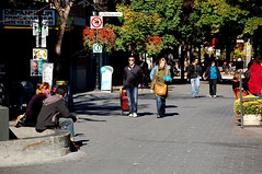
Shown here is Sai Yeung Choi Street in Kowloon’s Mong Kok district, which is car-free from 4pm-midnight every night — a switch only undertaken in the past few years. As you can see, a pedestrian street is not defined by the absence of cars: it’s about the abundance of pedestrians.

Kowloon’s main spine, Nathan Road, continues apace a block west, and alleys (really, just wide enough to push a cart down) are on either side should deliveries still be necessary. Of course, the other side streets are just as choked with pedestrians — often browsing at retail stalls, as on Tung Choi Street just east, and often sharing the space with the few cars who dare to brave the streets.

Of course, having stupendously high densities helps to sustain retail on both the arterials and the side streets, and the American tendency to have fewer but larger shops certainly doesn’t help.

Insisting that shoppers will materialize out of thin air just to see a place that’s interestingly designed, but inconvenient to get to — an “if you build it, they will come” approach — is backwards. Instead, retail is all about making things easy for customers, and the converse is true: “if they come, then you build it” (a nice echo of the aphorism that “retail follows rooftops”).

This strategy kind of mirrors the suburban lifestyle center approach: the arterial is still there to handle circulation, but the inviting environment is off to the side.

A similar approach here in North America was taken on Rue Prince-Arthur in Montreal’s lively Plateau neighborhood, a pedestrian street that links two parallel main streets (St. Laurent and St. Denis).

Chinatowns gentrifying even across the Pacific

I’ve written earlier on gentrification in U.S. Chinatowns (as with everything else, Manhattan gets more than its share of attention). Yet this is something new: gentrification (including, apparently, a shift to a whiter population) has occurred even in cities with large Asian majorities, like Honolulu, Vancouver, or even Singapore.

The broader context matters little: in these cities, Chinatown is the original ethnic neighborhood, offering vintage architecture (and, in both instances, unusually well-preserved) adjacent to the CBD. Just as in Los Angeles (where gentrification’s further along in Little Tokyo than in Chinatown), that proves an unbeatable combination for boutiquey businesses appealing to hip travelers or expats — who might find most local neighborhoods, with their preponderance of concrete apartments and enclosed malls, insufficiently “exotic” for their tastes.

Nuances of housing density

[h/t Kaid and Irwin Dawid/Planetizen for the video of Dan Zack’s density game]

Of course housing density is something that we must properly understand, and it’s a necessary (but insufficient) precondition for so much of what makes a great city — particularly the sustainability of services like retail and transit. However, there’s a danger in making it an end rather than a mean. So many other factors, like unit size, household size, parking ratios, landscaping, and occupancy rates (a high percentage of high-rise units are second homes) can have a huge effect on how density “lives” once it’s built.

For instance, the Cabrini-Green building shown is being replaced with three-story walkups that might have:
– the same DUA density
– higher occupancy rates
– higher impervious surface cover
– more living space per capita
– lower population density (much smaller households)
– higher income density (much higher household incomes)

Lower population density might mean lower transit ridership, but higher incomes mean that more retail space is needed.

Same windshield perspective

Jeff noticed a good dose of “windshield perspective” in the newspaper coverage of NYCDOT’s recent announcement that the Broadway pedestrian malls would be made permanent. Historically, newspapers have always represented a pretty upper middle class view of urban life — and that long has meant that they firmly took the side of drivers.

I saw an interesting illustration of this phenomenon recently, put into starker relief by the context. While I was in Hong Kong, the South China Morning Post had a long feature article (by Austin Chiu, 29 January; archives aren’t linkable) on how a few blocks of Ho Chung village was about to lose its only road. A notice had been posted to remove all cars from the village, since they’d soon be barricaded in — but one recent Anglophone arrival was peeved, adamantly maintaining that universal road access was “the responsibility of the government.” This is not a view that others, much less the government, seemed to share: 95% of households don’t own cars, and many thousands live far beyond the reach of cars — along narrow footpaths, up on steep hillsides, deep within complexes or high-rises. (It’s long been a goal of mine to live somewhere so far out of car culture’s reach that you physically can’t drive there.)

This article struck me as pretty strange on a few levels:
1. That a neighborhood could be made to go car-free
2. That road access was not widely understood as a universal entitlement
3. That such closures were not unusual
4. That someone could not notice something that seemingly obvious
5. That said person would bother complaining only at the last possible moment
6. That even the complaint was largely on procedural terms, about notification
7. That the newspaper would portray that complaint sympathetically, going so far as to point out how easy it would be for the government to build a bridge to replace the road (which crossed private land).

Actually, that last point is the least surprising one: it’s an English newspaper with a relatively wealthy readership who would sympathize better with the car-owning Anglo than with his car-free Chinese neighbors.

Off with their carpy heads

[I’ll be behind the Great Firewall of China for the next two weeks, and the GFW is as fine an excuse as I can find to not blog.]

[Post adapted from TNR comment]

I’ve been watching with some fascination the steady march of Asian carp species up the Mississippi basin and now, with alarm bells blazing at the US Supreme Court, across the Chicago Sanitary & Ship Canal portage. Several news reports of the carp’s advances have been accompanied by mention of Louisiana Wildlife & Fisheries’ “silverfin campaign” to promote fishing of invasive carp.

This approach would certainly solve the “no natural predators” problem that carp pose to Midwestern ecosystems. They’re huge, fleshy fish with acceptable taste (after all, they’re farmed for a reason) and a favorable nutrition profile. However, it’s difficult to see this actually evolving into much:

1. Their network of intramuscular Y-bones require considerable preparation in order to create those clean filets that Americans expect. If we’re going the “retail” route, consumers and anglers would need to actually learn something — not likely, and the Louisiana campaign seems to acknowledge this. Even if one were to take the wholesale route with machinery, existing fish processing equipment would have to be upgraded accordingly at considerable cost.

2. The carp population in many Mississippi basin waterways (like the Missouri) appears to have begun collapsing, having overshot its carrying capacity, so the available stock might be smaller than expected and perhaps not worth costly infrastructure investments (like processing plants).

3. Even if industrial processing existed, there’s no good industrial-scale way of catching river carp for processing into fish meal (whether for pet food, farmed salmon food, or fish sticks). Fish meal swept into monstrous nets by oceangoing factory ships is probably cheaper and easier, on a per-ton basis. And there’s not much use selling fish back to China, since they can always farm fish cheaper than we can.

Harlem “transition” missing the point

Sheesh, white privilege can result in such blinders. A NYT article by Sam Roberts bears a headline proclaiming that blacks are now less than half of Harlem’s population. Oh really? I hadn’t noticed the last time I was at 125th & Manhattan Ave. The article has the usual “experts” talking about gentrification and white-black relations, and the photo shows a white guy on a brownstone stoop. Yet an accompanying set of graphs shows a clear black majority in “central Harlem” (the area most residents would call Harlem) and a shrinking — but already minority — black plurality in “greater Harlem.” The “greater” area, it turns out, includes Spanish/East Harlem and much of Morningside Heights, neither of which have ever been majority black. Even within “central Harlem,” the graph shows a steep drop in the share of black residents beginning in 1980, long before the white gentry ever got to the neighborhood. In short, the graphs say that this was a poor neighborhood undergoing steady ethnic succession (by no means a new phenomenon; indeed, it’s the story of urban America) — from native-born black to Latino (a not-obvious shift, since many Caribbean immigrants blend the two categories) — and that minor gentrification has taken place over the past few years.

Basically, it’s not news (and we don’t even pretend to notice) until white people get there. This in spite of the fact that class, not race, is the real issue here and with gentrification in general; that households and not population are really the units of gentrification.

I’ll quote Brad Smith, who left this comment:

The Times places a photo of a white family at the top to suggest the displacement is because of whites. And most of the article concerns the influx of whites, suggesting the same cause. However, the accompanying graphs show the uptick in white families to be rather small, with “Other” constituting the real source of the population shift. Presumably, those are Hispanics but there is scant mention of them in the article… The loss of “majority” status has nothing to do with the influx of whites or the development boom of the past 10 years. So why is a white family featured in the photo and why is the demographic change repeatedly portrayed as a function of the influx of whites when the statistics and timeline say something else? The article is rather misleading and suggests an agenda.

A little fine print to boost tourism

Buried within the super-fine-print fare rules for any United Airlines domestic airfare purchase is this condition:

“STOPOVERS WITHIN CONTIGUOUS U.S.A. 2 STOPOVERS PERMITTED – 1 IN EACH DIRECTION IN DEN AT USD 55.81 EACH. NOTE – NOT VALID ON NONSTOP ROUTINGS OR ROUTINGS THAT DO NOT HAVE DEN AS AN INTERMEDIATE POINT.”

This essentially allows anyone traveling cross-country to visit Denver for $60 ($55.81+taxes); here’s how it works in real life. It’s there because Denver mayor John Hickenlooper asked for it — he figured that if some of the millions of passengers who connect through DEN annually might want to spend a few days in town. And I know that I’ve booked several of these stopovers, and paid a premium to United for that privilege.

I mention this since, well, United Airlines owes the city of Chicago more than a few favors — we, or rather our TIF districts, have just been so darn generous to them lately. Sure, I know that Mayor Daley would like to cash in those favors to get the O’Hare Modernization Program (and its scads of jobs) done. Yet here’s an easy ask: just add “OR ORD” twice into the above phrase, and a few of the 30 million United passengers who flow through ORD every year might find themselves heading into town to spend cash at Chicago’s amazing restaurants, hotels, and shops. (And since airlines are highly competitive, American and Southwest just might be compelled to match — doubling the potential audience.) I know that friends of mine “wish” they could easily stop by and go out for a drink in town rather than wait around ORD, but right now it isn’t possible without “breaking the fare.” Just adding ten letters could fix that. (Of course, it’d be even better if it could also apply to international itineraries.)

As for advertising such a program, Chicago-based Orbitz might be able to find a way to target the intended audience (i.e., people searching for flights that might connect through Chicago) right at the moment of purchase. The city also ultimately controls a lot of advertising opportunities at the airports themselves — that is, until the airports are privatized.

Urbanism gets people out of cars

New Urban News has recently presented some survey research done comparing greenfield new urbanism with nearby sprawl around Calgary, Montreal, Portland, and Toronto [article on Canada and on Portland]. Among the hypotheses tested is that New Urbanism, by creating places where walking is more possible and more pleasant, can cut driving trips and increase non-motorized mode share. (A common complaint about contrasting travel behaviors for residents of existing places — say, between old urbanism and new suburbs — is that the populations aren’t always comparable, and that selection biases are more likely.) One potential way of proving this would be to compare the walk/bike and transit share for commute vs. recreational trips: transit mode share for commuting is unlikely to differ substantially, since all of the locations are in the suburbs where work destinations are widely dispersed. (As we’ve noted before, most of the difference between European and American cities’ modal splits lies not in an increased share for transit, but in a much higher share for walk/bike trips.)

Sure enough, there’s a big difference in how residents of new urbanist neighborhoods travel within their neighborhoods and a mild difference in how they travel regionally. At Orenco Station west of Portland, residents are 10X more likely to regularly walk to shops than residents of a nearby subdivision; indeed, only 7% of Orenco residents don’t walk to the store, vs. 58% in sprawl. Occasional transit use is 60% higher among Orenco residents, even though both subdivisions studied are a five-minute walk from light rail stations; 65% report using transit more since moving in, vs. 23% in sprawl. Yet transit use for commuting is identical in both neighborhoods.

The Canadian study found a 8-point difference in driving’s mode share between new urbanism and sprawl, resulting in 19% fewer vehicle kilometers traveled. Yet the mode share of transit was the same, at 9%; the difference was solely in walking and cycling. Residents of new urbanism are 2.7X more likely to regularly walk or bike to local stores. (This is a lower factor than at Orenco; not all of the Canadian neighborhoods had town centers as comprehensive as Orenco’s, and the baseline sprawl figure in denser Canada is much higher.) 37% report walking “a lot more” since moving (85% higher than in sprawl), perhaps because 55% said their streets’ designs were “very safe” for walking and biking (49% higher than sprawl).

Some critics of New Urbanism loudly disclaim the physical determinism that some New Urbanists proclaim — often stating that neighborhood design has profound social ramifications. I have generally remained less sanguine about new urbanism’s impacts on social capital, but the impact of urban design on transportation choices seems pretty clear: if you give people safe, pleasant routes to quickly walk/bike to convenient destinations, they will walk and bike more.

The research also shows that New Urbanism is more than just a prettier version of sprawl. When done right, it has real effects on transportation outcomes — and, the surveys indicate, perhaps also social outcomes.

In related research, Robert Cervero at UC finds that even though peak parking demand at TOD apartment projects in the East Bay and PDX were similar to national ITE standards (just 5% lower), “trip generation rates for some projects were well below ITE standards.” This could indicate that TOD residents keep cars in storage due to subsidized parking — a great opportunity for expanded car-sharing services.

The possibility of selection bias still lurks behind all of this research: it could be that a small proportion of people are just predisposed to drive less. Even if that were the case, that choice should be applauded (since driving costs society), and places that allow people to express that preference should be encouraged. Yet this preference apparently isn’t nearly as much of a minority view as it might seem, particularly among younger Americans. A Concord Group survey of Millennial homebuyers, noted in Builder, found that 81% of young people thought living “near alternative modes of transit” to be “very or somewhat important.” A full 67% would pay more for that choice.

In other news about encouraging walking/cycling, this month’s “Mode Shift” includes a history of the Albany Home Zone. Traffic calming on Chicago’s side streets has long used just the blunt-force (and bicycle-unfriendly) tools of stop signs, speed bumps, and one-way restrictions; here’s a great opportunity to test out a wider menu of options.

Two leaps forward

How’d another few weeks disappear? Recent news: the Wicker Park Bucktown Master Plan, a three-year effort by WPB that I initiated and chaired the steering committee for, will receive the American Planning Association’s 2010 National Planning Excellence Award for Public Outreach. Our public outreach strategy centered on three Open Houses, designed as a fun and interactive way for residents and visitors to learn about the plan and share their ideas on their own schedule. Credit for the creative campaign that supported the Open Houses goes to Country Club Chicago for print and transit ads, and Interface Studio (our planners) for their video installation.

In an earlier post, I wrote about the potential of the PEIRurban sensing” project developed at UCLA and featured at Wired’s NextFest. Now this ubiquitous-computing strategy has found an even better vehicle, with the MIT Senseable City Lab’s Copenhagen Wheel. The customizable wheel incorporates a hub that goes far beyond three speeds: it adds ambient air quality, noise, and temperature sensors along with GPRS data and Bluetooth wireless to share that information with the network and your smartphone. What’s even better, it adds dynamic regenerative braking (with a motor, batteries, and torque sensor) — another long-held dream of mine. (Too bad their test bike looks like a ghost fixie.)

The Bluetooth connection might be an interesting way of integrating place-based rewards — a method that a shopowner could “validate” someone’s bike trip just like car-parking charges. The University of Minnesota will soon launch a program wherein frequent bike commuters with RFID tags on their bikes will get rewarded with discounts at an on-campus bike station, for example — and, if they’re employees, that benefit can come from pre-tax income under the new bike commuter benefits.

Crosswalk? Bah.

1. Who are the real scofflaws? In 15 min. observing a clearly marked zebra crosswalk at Milwaukee & Sawyer this afternoon, 92% of drivers refused to yield to pedestrians who had the right of way.

The average pedestrian was threatened by 7 motorist-criminals before she was able to exercise her lawful right to cross the street. Why should a pedestrian even bother crossing legally (and not just jaywalk) if drivers won’t let her cross in any case?

2. “Dangerous by Design” calculates that our local governments don’t particularly care, either; per-capita annual federal spending on active transportation in our region is a paltry $0.75, right down there with Houston, Detroit, and San Bernandino. If we matched #1 Providence at a mere $4 per capita, that’d be over $31M a year in additional investment annually.

Wary of the next spatial fix

Recently was skimming Jason Hackworth’s The Neoliberal City, wherein a primary argument is that gentrification is a spatial manifestation of neoliberal urban policies. I’m not entirely convinced — if anything, the relatively minor scale of gentrification as a force shaping cities (relative to, say, deindustrialization or large-scale immigration) points to the weakness of said policies — but in any case it reminded me of what David Harvey (PDF) called the spatial fix:

capitalism’s insatiable drive to resolve its inner crisis tendencies by geographical expansion and geographical restructuring… as an example, the key role of suburbanization in the United States after 1945 in absorbing surpluses of capital and labor.

It’s rare for these various fixes to be unwound, although it has happened before — the reversion of farms to forests in the East or the abandonment of railroad ROWs could be seen as repudiations of earlier expansionary policies. More likely, these earlier fixes were just forgotten and consigned to history’s dustbin as even bigger fixes (industrial agriculture and highways) took hold. Sure enough, we see two tendencies afoot: the immediate one being bailouts. Chris Leinberger refers to “the bailout of sprawl” as massive sums go into propping up the mortgage giants: “America has overbuilt auto-oriented fringe housing well beyond what the market wants… it is quite possible that this housing stock will continue to have a market price less than replacement value, as it is the case today.”

Meanwhile, cheerleader Richard Florida celebrates the idea of a new spatial fix, one which will knit together megalopolises:

It may well be impossible for sustained recovery to come from breathing life back into the banks, auto companies, and suburban-oriented development model. A new period of geographic expansion – or what geographers term a “new spatial fix” – will eventually be needed to spur a renewed era of economic growth and development.

As much fun as this “green Keynesianism” (Mike Davis) might be — and I’m sure it will bring fantastic new job prospects to the planning sector — there’s always a danger afoot. Richard Wells reminds us that prior spatial fixes existed to solve capital’s problems, not society’s, and that they’ve always involved considerable displacement, conflict, and struggle.

Hadn’t seen the Davis article before; it’s kind of “The Emerging Democratic Majority” all over again. Nice to see that even radical critics get that, though. Here’s a cute chart:

Edit to add: here’s a fun idea for a cartogram: take this table and size the states by their total property value, and by their total home equity. Yes, indeed, Nevada would vaporize in the latter!