Ivy City: who goes there?

Hecht Warehouse, Ivy City, DC

The view northeast from the Hecht Warehouse’s parking garage, towards “NewCityDC.” 

Last month, Douglas Development filed plans for NewCityDC, which will bring more than half a million more square feet of retail space to the New York Avenue NE corridor, adjacent to the substantial residential and retail investments it’s gradually opening around the old Hecht Company warehouse in Ivy City.

NY Ave, aka US 50, is the only full-on traffic sewer in DC, with six through lanes, a speed limit up to 50 MPH. For a three-mile stretch between the Maryland line and Florida Avenue (the boundary of the L’Enfant city), it’s paralleled on the north by a trench holding the Northeast Corridor railroad and cut off to the south by a variety of institutions (the arboretum, Gallaudet University, cemeteries), and thus has only a handful of intersections with the street grid. That proximity to the railroad brought both low-density industrial buildings and a Skid Row feeling to the blocks surrounding it. The street hardly has sidewalks, definitely does not have bike lanes, and doesn’t even have a city bus route.

Yet despite all that, Douglas — who has made a fortune turning around the East End of downtown DC — thinks there are customers for 300,000 square feet (a regional mall’s worth, net of the anchor stores) of specialty retail in this isolated location. And they’re sinking lots of money into the area; this is some very heavy-duty and expensive work to do for single-level retail:

After Hecht, Douglas' next retail building

Douglas’ marketing would have retailers think that there are lots of customers right at their doorstep, thanks to dubious maps like this “trade area analysis”:

hecht2

The map gooses up the demographics by drawing a “15-minute drive time” radius that brings everything from College Park to Georgetown to Pentagon City into the mix — even though

  1. Georgetown is almost never a 15-minute drive to Ivy City;
  2. More than half of households in the Census tracts surrounding Ivy City do not own cars, along with about 40% of central-city households;
  3. Most residents west of this site may be only scarcely aware that New York Avenue, much less Ivy City, exists.

“Average household income” is basically meaningless, especially in prosperous (and expensive) metro DC, since all three of those figures are substantially below the city average of $106,000.

A site-and-vicinity map is even more misleading:

hecht1

This map highlights thousands of apartments that are being delivered around NoMA. Never mind that many of those new units don’t have parking spaces (since most of the city’s new households don’t have cars), which will make it nearly impossible for their residents to get to Ivy City.

Sure, Hecht is a 4-minute drive from NoMA, and a mere 3/4 mile for any birds who are roosting atop its new high-rises. But for most anyone who actually lives in NoMA, it’s nearly half an hour away (by bus and foot) — during which time that resident could have just gone to Metro Center (with 15 minutes to spare) or Pentagon City or Silver Spring. In short:

The real market for Hecht, NewCityDC, and Fort Lincoln’s retail is exactly what you’ll see in the parking lot at the Costco at the latter: lots of Maryland license plates. All of these are set up for easy right-in/right-out access for drivers headed outbound on US-50, who don’t have many other shopping choices until Bowie or Annapolis. That market is certainly underserved — but it’s much smaller than the one that Douglas’ maps promise. Economic development officials in Prince George’s County should take note.

Help, a mall ate my walk shed

Mall entrance

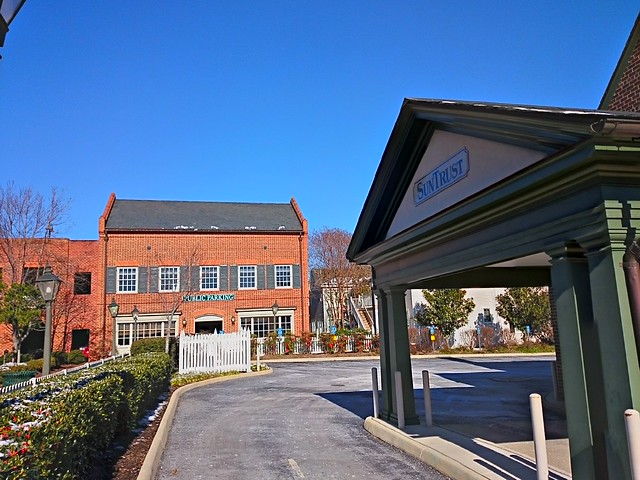
The entrance to Hong Kong’s airport express train is somewhere within this mall. The cross-border bus terminal entrance is somewhere else entirely, and the actual “public” spaces are completely dispiriting.

When I was a small child, John Portman-style complexes were architecture’s futuristic vision: Someday, we’d all live in hermetically sealed downtown compounds of office and hotel skyscrapers set atop multi-story podiums.

My family stayed in several of these hotels on trips; sometimes, my mom would tell me about how she, as a child in Hong Kong, had dreamed of a city of skyscrapers and layers of indoor shops, all suspended above grade so that buses, boats, and cars could fill the ground plane.

That hyper-dense Modernist vision eventually came to pass in much of central Hong Kong, fed by not only its unique geography but also by its unique private-provision model for both rail and property. There’s danger, it turns out, in putting developers in charge of your rail stations; the “gift horse” of free infrastructure comes with strings attached.

When private firms are put in charge of designing pedestrian circulation networks, they will place their values — primarily shuffling eyeballs past storefronts — over the public’s need for legible, direct links from A to B. The tremendously high value of rail access behooves developers to elbow their way closer to the station; the location imperative isn’t to be near transit, it is to be at transit; to make it not just easy, but necessary to traverse their property. And, once the development has cornered the transit station, it will seek to entrap the resulting pedestrian flows within a spiderweb of passages. As Chris DeWolf writes:

Last month, a survey of 657 Tsim Sha Tsui pedestrians conducted by urban design watchdog Designing Hong Kong revealed that 77 percent prefer using street-level crossings over footbridges and subways… “The problem is that bridges and tunnels force you into particular routes that limit your ability to take the shortest path,” says Designing Hong Kong convenor Paul Zimmerman. “People also pick attractive routes. That’s a very qualitative statement, but part of what makes a route attractive is being able to see other people, to window shop, to have an experience. With subways and footbridges that becomes quite limited.”

An early version of this phenomenon can be seen in Montreal’s underground city, the most valuable retail frontage is as close to the train platforms as possible. Thus (almost as in casinos) the developers twist and turn the corridors to herd people past the shops. Future iterations of the phenomenon will soon be unveiled at the World Trade Center mall and at Hudson Yards.

Edit 7 Jul 18: author Marion Girodo has a book of “urban mangroves,” the multilevel urbanism that crops up around metro stations in Montreal, Paris, and Singapore.

Edit 17 Jan 17: Henry Grabar in Gothamist writes of “the oculus”: “If Grand Central is a train station with some shops, the Oculus is a shopping center with some trains.”

New PATH - WTC underground passage

Want to get to the PATH, or cross West Street to get to the Hudson? You’ll have to walk down this hall, and oh by the way there are plenty of shopping opportunities.  

A similar landscape may be emerging at Tysons Corner, where the in-process retrofitted suburbia — now and forevermore ridden with alienating highways — shows little sign of ever becoming a Greenwich Village sort of urbanism with small blocks of public streets lined with small-but-tall buildings. Instead, the spatial complexity that’s emerging is of a very different, much more Portman-esque sort. Philip Kennicott writes in the Post:

The decision to elevate the stations — a far less expensive approach than burying them — may well presage this sleek new world of elevated plazas and public areas, disconnected from the ground. A new office building across from the Tysons Corner station is built atop a parking garage, so that at ground level one faces a seemingly impenetrable plinth. Already, a web of pedestrian bridges — some built by Metro, others by private developers — is emerging, keeping us safely above the world of machines and hydrocarbons and asphalt…

One wonders if you will emerge from these stations with [a] sense of pleasant surprise and rootedness in the urban landscape… Likely not. Rather, you will emerge, slightly disoriented by the ever sameness of the commercial and physical space around you, wondering for a moment if you have arrived at the right station, before your basic sense of purpose — to get home, to find a restaurant, to locate a shop — kicks in, and you begin to move by habit and instinct through a pleasantly unobtrusive world of concrete and glass that could be anywhere.

Tysons Corner Center expansion

Tysons Corner Center’s “Metro Plaza” under construction. At left, the bridge to the station, at right, the bridge to the mall.

At Tysons Corner Center, the megamall at the heart of Tysons, building a bridge keeps the distance from station to mall is 300 feet — a 1.6 minute walk. The bridge siphons customers directly into the mall, creating tremendous value in three dimensions: “You’ve got a first floor on the first floor and a first floor on the second floor, so you’ve solved the verticality problem” [of pulling mall foot traffic from the entry to different levels], Timothy Steffan, an executive for mall owner Macerich, told the Post’s Jonathan O’Connell.

This Disney-esque strategy of spiriting people directly into an immersive environment has ample precedent: in fact, Roppongi Hills, a fantastically successful redevelopment in the heart of Tokyo, also uses an elevated plaza to deliver customers from the subway onto the development’s podium. The experience for customers who drive in is akin to what Rick Caruso’s malls or skyway’d downtowns provide: parking garages deadening the street environment all around, but a fantastic public space within. Sure, bus and bike customers have to deal with an ugly exterior, but the privileged modes (driving and heavy rail) get the red carpet.

Amazingly not Portman: Plaza of the Americas

Skyway urbanism in Dallas

My first instinct is to warn “creative” policymakers to be careful what you wish for: these projects result in such high cost and complexity that the only financially worthwhile result is a giant mall. They’re so huge, boring, and bland because of private value capture. Finding room in a private developer’s pro forma to build expensive underground rail infrastructure requires selling stupendous quantities of expensive corporate real estate, which will never be cool and lively. It also requires generous, greenfield-esque parcel sizes. In the worst case scenario, the project fails, and there’s nothing worse than a white elephant in the middle of the room.

Yet as dispiriting as these initial examples are, there’s a glimmer of hope that they’ll eventually be okay. With enough time, enough density, and enough owners, even these bland malls could evolve into something interesting. Hong Kong’s experience shows how the weird linkages that result from generations of ad-hoc decisions and relentless foot-traffic flows have created a hyper-dense end result that can be beautifully complex in a postmodern, emergent-urbanism way. This isn’t immediately apparent from the workaday commercial architecture, but can be mesmerizing when expressed in diagram form — as the recent book Cities Without Ground shows (high-res image slideshow). A two-dimensional plan, or even a figure-ground diagram, is useless when expressing vertical spaces.

Hong Kong architect Peter Cookson Smith described this structure in more essentialist terms in The Urban Design of Impermanence (pg. 84; excerpt):

A cityscape of streets, internalized routes and multi-level links, even without clear articulation, is open to casual exploration, and there is little need for city form to be overly organized or pronounced in order to be legible… This underlines an essential difference between the formal framework of Western public spaces and the more diffused and informal realm of social space associated with the Hong Kong street, where the relationship between public and private spaces is less tangible, and the routes between them work just as effectively in three dimensions as in two.

Perhaps China’s homogeneity and sheer density (bear in mind this is about 1-2 orders of magnitude higher than urban America’s) might increase social trust and thus break down the hierarchy of spaces — people there feel more comfortable wandering down dark alleys. Yet perhaps we could shortcut to that future: emerging spatial technologies, like smartphone-based mapping, are quickly obviating highly legible spatial hierarchies. Customers can now just as easily find a shop hidden in the back corner of a buildings as one that shouts its presence with highway-sized signs.

Or maybe not. Toronto’s PATH system is now 40-odd years old, serves more than 100,000 pedestrians a day (so many that its closure would send downtown into gridlock), and has apparently outcompeted street-level retail spaces. It’s also a navigational nightmare of corporate sameness, according to Spacing’s Kieran Delamont:

The PATH is a mall, first and foremost. Beyond access to over half a dozen food courts, at least two massage parlours, and more sushi restaurants than I cared to count, I put it to you that, with its existing wayfinding system still in place, the PATH offers nothing especially preferable over supra-terranean navigation… It is a seemingly endless maze of mall corridors, hallways, and atriums. Unless you are a person for whom the distinctions between Jamba Juice and Jugo Juice are particularly meaningful, everything in this place feels exactly the same; with each new tunnel you encounter in here, the space expands physically while being visually constricted. Because this space lacks the distinctive landmarks that you often find above ground, there is very little to distinguish it from every other mall you’ve been in. The more of it you explore, the less it feels like you could ever remember any of it…

The balance between mall and transit network is slanted heavily towards the PATH’s commercial interests; the dominant incentive of the landowners is to keep you in their slice of the PATH, not to move you through efficiently.

What we need are architects and developers who understand that, and aren’t afraid to create more interesting, if less-legible and less predictable, places — perhaps even fractal-like, medieval-esque street plans in three dimensions.

Sai Yeung Choi St

America’s lower urban densities mean that our over-commercialized transit districts may never quite achieve this level of spatial complexity, but by golly, why not try? 

[Previous transit-station walk shed coverage: walk sheds & excessively grand rail stations, walk sheds & water transit]

Friday photo: Incrementalist lessons from Seaside

Seaside lessons: plan for evolution, not revolution

The ULI office is moving in a few months, so a lot of old files are being tossed out. One that I saw poking out of a garbage can was a 1986 Project Reference File written about Seaside, Florida. The “lessons learned” section worth excerpting, if only because it doesn’t talk about the PoMo architecture, or even the planning — instead, it’s all about the incremental nature of the development.

Most resort development today is characterized by a highly refined design concept coupled with central ownership and tight control over design and building decisions. In contrast, Seaside’s approach is to encourage authentic diversity by delegating to others as many design decisions as possible, within the dictates of a sophisticated urban design plan….

A significant factor in Seaside’s development is that, by owning the land outright, Davis was able to 1) invest in a considerable amount of upfront planning, and 2) proceed cautiously with the development. By going slowly, he says, a developer can reduce risk and can correct small mistakes. At Seaside, the master plan was not recorded until after the developer had had several years of experience with building and marketing this unique product. This allowed for minor refinements in the development strategy, plan, and timing, while prices rose accordingly….

Instead of assuming that large upfront investments in amenities would produce marketing payoffs, the developer moved slowly and carefully, guided by the master plan.

In short, plan far ahead, regulate what matters, and phase to allow adaptation and evolution. (Evolution, not revolution.) Alas, the world still has a lot to learn from Seaside.

This point is echoed by Peter Cookson Smith in a book that I’m reading about Hong Kong, a seemingly very different place:

Overly engineered environments leave little flexibility to make incremental adjustments in response to the evolving economic circumstances that normally represent the lifeblood of towns and cities.

Cartographic pet peeve: Who skipped 94101?

94101

For most US cities, I can quickly get a map zoomed right to the central city by going to most any mapping application and typing in a five-digit ZIP code that ends in “01.” That’s because the first three digits of any ZIP code are actually a meta-ZIP, best known by the Census Bureau’s term “ZCTA3.”

Back when ZIPs were assigned, the large post offices that served entire cities or broad rural areas were assigned these three-digit codes, and subareas within them were numbered off in roughly concentric order from the sorting center. ZIP code XYZ01, then, was usually at the then-principal post office, either right downtown or by the railyards where mail was usually offloaded then.

The Post Office assigned these codes in an ascending order following a meandering east-west path across the Lower 48, beginning in New England and ending in the Northwest. Thus, it’s not terribly difficult to remember a city’s ZCTA3 — since they’re systematic, it’s easier than memorizing cities’ telephone area codes (a taxonomy that, while having its own charming history, is increasingly irrelevant).

  • Boston 021
  • New York City 100
  • Pittsburgh 152
  • Philadelphia 191
  • Washington 200
  • Raleigh 276
  • Durham 277
  • Atlanta 303
  • Miami 331
  • Minneapolis 554
  • Chicago 606
  • Denver 802
  • Los Angeles 900
  • Portland 972
  • Seattle 981

BUT there’s one (one!) exception that thwarts my little mnemonic: San Francisco. Its ZCTA3 is 941, but there is no 94101; the lowest-numbered ZIP in town, centered on the main post office by the Civic Center, is 94102. Who stole 94101?!

Postscript via Eric Fischer, proud owner of a pre-ZIP postal map:

//platform.twitter.com/widgets.js

The crisis sharpened the segregation tax, with effects that will reverberate for generations

This sharp illustration of “the segregation tax” comes courtesy of DePaul’s Institute for Housing Studies. Calumet City has a housing stock comparable in age to that in Park Ridge or Des Plaines (areas whose development started in the 1920s, but mostly occurred in the 1950s); Harvey’s is mostly post-war. Similarly, Chatham, Auburn-Gresham, and Avondale all are principally 1920s bungalows and two-flats, with Logan Square having a large fraction of pre-WW1 houses and flats.

Prices in the mid-2000s boom rose substantially in all neighborhoods, fed by ample access to both prime and subprime loans. Even “during one of the hottest housing markets ever, our numbers were showing black buyers still experienced [home equity] losses,” notes Scott Holupka, pointing to disadvantageous subprime loans and inflated prices in segregated neighborhoods.

But the picture in the aftermath of the 2008 crisis has been terrible for majority-Black areas on the South Side, like Calumet City, Harvey, Chatham, and Auburn-Gresham. The “boom” has left huge numbers of Black homeowners underwater, without access to a ready market of creditworthy buyers, and in neighborhoods with sinking home values. On the White or Latino-plurality North Side, values didn’t fall as far during the bust, and have rebounded further since.

These diverging fortunes show that simply achieving milestones like buying a home, or graduating from college, isn’t enough — a deed or diploma’s value is socially constructed, and subsequent policies can do much to determine their future value. A study by Demos finds that the subsequent returns to education and homeownership matter just as much as equalizing access to such wealth-building opportunities:

Eliminating the racial disparity between Blacks and Whites in… would reduce the wealth gap by:
– Homeownership rates: -31%
– Returns on homeownership: -16%
– College graduation rates: -1%
– Returns on college graduation: -10%
– Incomes: -11%
– Returns on income [nil]

Note that equalizing incomes today won’t necessarily have an impact on the wealth that Black families will be able to pass on to future generations: “Even with equal advances in income, education, and other factors, wealth grows at far lower rates for black households because they usually need to use financial gains for everyday needs rather than long-term savings and asset building.”

Mel Jones, in a recent Washington Monthly article, points to how the widening wealth gap presents a particular disadvantage to young Americans of color:

You can’t discuss wealth inequality without talking about race; within the American context, they are inseparable. So the fact that Millennials of color feel the impact of a precarious financial foundation more acutely is not a surprise. For black Millennials in particular, studies point to a legacy of discrimination over several centuries that contributed to less inherited wealth passed down from previous generations. This financial disparity stems from continuous shortfalls in their parents’ net worth and low homeownership rates among blacks, which works to create an unlevel playing field.

Whereas many white Boomers may have used home equity loans to help pay college tuition bills, many black Boomers have negative equity to invest in their children’s education, in their own health, in getting their grandchildren a solid start. The accumulated disparities will cascade down to future generations.

Policies to more equitably distribute the returns on homeownership will have to act on both sides of the crosstown divide — not only lifting up the disadvantaged, but also moderating the outsize gains enjoyed by the “favored quarter.” Economic development should occur more equitably across regions, to help boost demand. However, this difficult task will be easy compared to better integrating the favored quarter, bringing more people closer to high-opportunity places.

Friday photo: Merchants Square

Colonial Williamsburg: Merchants Square (1920s shopping center)

The entrance to ye olde Public Parking lies immediately beyond ye ancient Bank Drive Thru… Jokes aside, Colonial Williamsburg’s Merchants Square is an interesting 1930s-era transitional exercise in proto-shopping center design. As the site’s National Register nomination notes, this development largely explains why early shopping centers on the East Coast adopted a “Colonial” dress with red bricks, white columns, and pitched roofs. I wish that more of the era’s shopping centers had taken its lead in planning, rather than architecture, and moved the parking from in front to mid-block.

On a recent visit, it was surprising to see how far retail has sprawled around Williamsburg — exacerbated, no doubt, by sales-tax revenue rivalry between the City of Williamsburg and the surrounding James City County. Yet many of the new “lifestyle shopping villages” at the outskirts, namely New Town and High Street, suffer from subpar locations and high vacancy rates, and none has emerged as the Class A champion. I wonder how a less conservatively managed Merchants Square could have grown by just one or two more blocks north or south, adapting to the town’s growing and changing clientele of students, local residents, and tourists. Alas, we will never know.